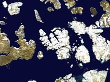
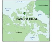
Bathurst Island (Nunavut)
Uninhabited member of the Queen Elizabeth Islands, Nunavut, CanadaBathurst Island is one of the Queen Elizabeth Islands in Nunavut, Canada. It is a member of the Arctic Archipelago. An uninhabited island, the area is estimated at 16,042 km2 (6,194 sq mi), 185 to 188 km long and from 101 km (63 mi) to 116 km (72 mi) to 149.5 km (92.9 mi) wide, making it Canada's 13th largest island. It is located between Devon Island and Cornwallis Island in the east, and Melville Island in the west. Four small islands of Cameron, Vanier, Massey and Alexander lie in its northwest.
Read article
Top Questions
AI generatedMore questions


