Barmston, East Riding of Yorkshire
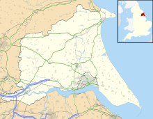
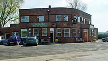
Village in the East Riding of Yorkshire, EnglandBarmston is a village and civil parish in the East Riding of Yorkshire, England. It is situated on the Holderness coast, overlooking the North Sea and to the east of the A165 road. Barmston is approximately 6 miles (10 km) south of Bridlington town centre. The parish includes the village of Fraisthorpe, the former villages of Auburn and Hartburn have been abandoned due to coastal erosion. Barmston is mentioned in the Domesday Book as having eight ploughlands and belonging to Drogo of la Beuvrière. The name of the village derives from Beorn's Tūn. According to the 2011 UK census, Barmston and Fraisthorpe parish had a population of 275, a slight decrease on the 2001 UK census figure of 277. The parish covering an area of 1,765.014 hectares.
Read article
Top Questions
AI generatedMore questions
Nearby Places

Lissett
Village in the East Riding of Yorkshire, England

A165 road
Road in Yorkshire, England

Ulrome
Village in the East Riding of Yorkshire, England

Fraisthorpe
Village in the East Riding of Yorkshire, England

Gransmoor
Hamlet in the East Riding of Yorkshire, England
RAF Lissett
Royal Air Force base in Yorkshire, England

Fraisthorpe Wind Farm
Wind power generating site in the East Riding of Yorkshire, England

Barmston Lifeboat Station
Former RNLI lifeboat station in the East Riding of Yorkshire, England


