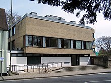
Banbury Road
Arterial road in Oxford, EnglandBanbury Road is a major arterial road in Oxford, England, running from St Giles' at the south end, north towards Banbury through the leafy suburb of North Oxford and Summertown, with its local shopping centre. Parallel and to the west is the Woodstock Road, which it meets at the junction with St Giles'. To the north, Banbury Road meets the Oxford Ring Road at a roundabout. The road is designated the A4165. Prior to the building of the M40 motorway extension in 1990, the road formed part of the A423 from Maidenhead to Coventry.
Read article
Top Questions
AI generatedMore questions
Nearby Places

BBC Radio Oxford
Radio station in Oxford

Summer Fields School
Private preparatory school in Oxford, England

Summertown, Oxford
Human settlement in England

South Parade
Shopping street in North Oxford, England
Sunnymead
Human settlement in England
The Tolkien Trust

North Wall Arts Centre

Lonsdale Road
Road in Summertown, North Oxford, England


