Ardagh, County Limerick
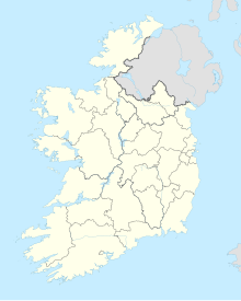
Village in County Limerick, IrelandArdagh is a village and civil parish in County Limerick, Ireland. The village is situated round the junctions of the R523 and R521 roads. The nearest town is Newcastle West, 5 kilometres (3 mi) to the south. Primary level education for the village and its surroundings is provided by St Molua's National School. The parish is bounded to the west by Athea, to the north by the parish of Coolcappa, to the east Rathkeale and to the south by Newcastle West. The local GAA club is St. Kierans which represents both the parish of Ardagh-Carrigkerry as well as Coolcappagh-Kilcolman.
Read article
Top Questions
AI generatedMore questions
Nearby Places

Newcastle West
Town in County Limerick, Ireland

Mahoonagh
Village in County Limerick, Ireland
Knockaderry
Village in County Limerick, Ireland

Newcastle West GAA
Gaelic sports club in County Limerick, Ireland
Ballygowan water
Brand of mineral water

Ardagh Fort
Ringfort (rath) in County Limerick, Ireland

Desmond Hall and Castle
Castle and great hall in County Limerick, Ireland

Carrigkerry
Village in County Limerick, Ireland


