Antsiranana Bay
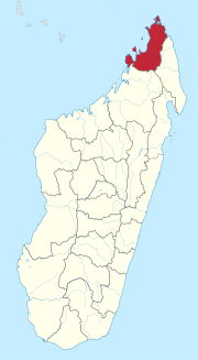
Natural bay along the northeast coast of MadagascarAntsiranana Bay is a natural bay that stretches close to 20 kilometres (12 mi) north to south along the northeast coast of Madagascar. The waters average a depth of more than 20 metres (66 ft), and the main channel can be as deep as 50 metres (160 ft). The bay, protected by a narrow inlet that provides shelter from strong Indian Ocean winds, is believed to be the result of a submerging coastline or a drowned river valley that formed many peninsulas around the bay.
Read article
Top Questions
AI generatedMore questions


