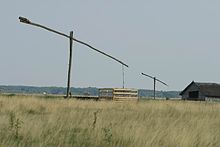
Great Hungarian Plain
Largest part of the Pannonian PlainThe Great Hungarian Plain is a plain occupying the majority of the modern territory of Hungary. It is the largest part of the wider Pannonian Plain. Its territory significantly shrank due to its eastern and southern boundaries being adjusted by the new political borders created after World War I when the Treaty of Trianon was signed in 1920.
Read article
Top Questions
AI generatedMore questions


