Albion River
River in Mendocino County, California (USA)The Albion River is an 18.1-mile-long (29.1 km) river in Mendocino County, California. The river drains about 43 square miles (110 km2) on the Mendocino Coast and empties into the Pacific Ocean near the town of Albion, California, where California State Route 1 crosses it on the Albion River Bridge. The river's overall direction is east to west, but it moves significantly in the north–south direction. The tributaries of the river include Railroad Gulch, Pleasant Valley Creek, Duck Pond Gulch, South Fork Albion River, Tom Bell Creek, North Fork Albion River, and Marsh Creek. The river's most inland point is only 15 miles (24 km) from the coast, and its highest elevation is about 1,570 feet (480 m) above sea level. There is a large estuary at the mouth of the river, and tidal waters travel up to 5 miles (8 km) upstream. The Albion River was previously used to power a sawmill on the river mouth, but there are no major dams or reservoirs on the river. The river provides recreation, groundwater recharge and industrial water supply for the community of Albion, and wildlife habitat including cold freshwater habitat for fish migration and spawning.
Read article


Top Questions
AI generatedMore questions
Nearby Places

Albion, California
Census-designated place in California, United States
Little Salmon Creek (Mendocino County)
Stream in Mendocino County, California
Whitesboro, California
Unincorporated community in California, United States
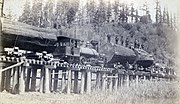
Fort Bragg and Southeastern Railroad
Former railway line in California, US

Albion River Bridge
Bridge in California
Albion Field Station
Big Salmon Creek (California)
Stream in Mendocino County, California (USA), north of Albion

Orrs Creek
River in California, United States