Aisgill
Human settlement in EnglandAisgill is the southernmost of the hamlets that form the parish of Mallerstang in the English county of Cumbria. It is on the B6259 road, at the head of Mallerstang dale, just before the boundary between Cumbria and North Yorkshire.
Read article


_Princess_Royal_Class_7P_No._6203_(British_Railways_8P_No._46203)_Princess_Margaret_Rose,_steam_locomotive,_Aisgill_summit,_Settle_to_Carlisle_line,_1993.jpg)
Top Questions
AI generatedMore questions
Nearby Places

Hawes Junction rail crash
Railway crash in England in 1910

1913 Ais Gill rail accident
Train crash in Cumbria, England
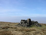
Wild Boar Fell
Mountain in Cumbria, England
1995 Ais Gill rail accident
Rail accident in the United Kingdom

Eden Sike Cave

Swarth Fell

Grisedale
Dale in Cumbria, England

Lunds, North Yorkshire
Hamlet in North Yorkshire, England