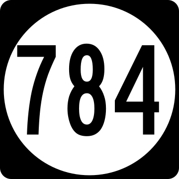
State Route 784 (SR 784) in the U.S. state of Virginia is a secondary route designation applied to multiple discontinuous road segments among the many counties. The list below describes the sections in each county that are designated SR 784.
| Route information | |
|---|---|
| Maintained by VDOT | |
| Location | |
| Country | United States |
| State | Virginia |
| Highway system | |
List
| County | Length (mi) |
Length (km) |
From | Via | To | Notes |
|---|---|---|---|---|---|---|
| Accomack[1] | 0.10 | 0.16 | SR 2601 (Junior Street) | Middle Street | SR 180 (Harborton Road/Shore Drive) | |
| Albemarle[2] | 3.20 | 5.15 | Dead End | Burnt Mill Road Doctors Crossing Road |
SR 640 (Gilbert Station Road) | Gap between segments ending at different points along SR 600 |
| Amherst[3] | 1.00 | 1.61 | SR 151 (Patrick Henry Highway) | Canodys Store Road | SR 151 (Patrick Henry Highway) | |
| Augusta[4] | 2.30 | 3.70 | SR 785 (Madrid Road) | Pine Bluff Road Round Hill Road |
SR 617 (Round Hill School Road) | |
| Bedford[5] | 4.50 | 7.24 | SR 714 (Falling Creek Road) | Nicopolis Road Triggs Road |
US 460 (Lynchburg Salem Turnpike) | Gap between segments ending at different points along SR 715 |
| Botetourt[6] | 0.15 | 0.24 | Dead End | Swartz Road | SR 640 (Lithia Road) | |
| Campbell[7] | 0.42 | 0.68 | SR 683 (Lawyers Road) | Winebarger Circle | SR 683 (Lawyers Road) | |
| Carroll[8] | 0.30 | 0.48 | SR 100 (Sylvatus Highway) | Rock Creek Road Baker Mines Road |
Dead End | |
| Chesterfield[9] | 0.85 | 1.37 | Dead End | Bailey Farm Road | SR 604 (Genito Road) | |
| Fairfax[10] | 0.94 | 1.51 | SR 655 (Blake Lane) | Hibbard Street | Dead End | |
| Fauquier[11] | 0.15 | 0.24 | SR 626 (Loudoun Avenue) | Lee Street | The Plains town limits | |
| Franklin[12] | 1.04 | 1.67 | SR 623 (Ingramville Road) | Pernello Road | SR 781 (King Richard Road) | |
| Frederick[13] | 0.10 | 0.16 | Winchester city limits | Smithfield Avenue | SR 783 (Brick Kiln Avenue) | |
| Halifax[14] | 1.70 | 2.74 | SR 626 (Clarkton Road) | Mason Trail | Dead End | |
| Hanover[15] | 0.30 | 0.48 | Dead End | Talley Pond Road | SR 799 (Woodlawn Drive) | |
| Henry[16] | 0.30 | 0.48 | Dead End | Harmon Hill Road | SR 667 (Koehler Road) | |
| James City[17] | 0.11 | 0.18 | Cul-de-Sac | Iron Bound Road | SR 615 (Ironbound Road) | |
| Loudoun[18] | 0.40 | 0.64 | SR 727 (Forest Mills Road) | Ward Hill Road | SR 725 (Hughesville Road) | |
| Louisa[19] | 0.53 | 0.85 | SR 687 (Daniel Road) | Bailey Drive | Cul-de-Sac | |
| Mecklenburg[20] | 1.09 | 1.75 | SR 722 (Burlington Drive) | Iron Gate Road | FR-1069 | |
| Montgomery[21] | 0.42 | 0.68 | Dead End | Fallam Road | SR 625 (Big Falls Road) | |
| Pittsylvania[22] | 0.40 | 0.64 | Dead End | Gunn Lane | SR 713 (Birch Creek Road) | |
| Prince William[23] | 7.97 | 12.83 | SR 642 (Hoadley Road) | Dale Boulevard | US 1 (Jefferson Davis Highway)/SR 1392 (Rippon Boulevard) | |
| Pulaski[24] | 0.37 | 0.60 | SR 611 (Newbern Road) | Hance Road | Dead End | |
| Roanoke[25] | 0.06 | 0.10 | SR 797 (Barrens Road) | Sudley Road | SR 1858 (Buckland Mill Road) | |
| Rockbridge[26] | 0.30 | 0.48 | SR 1111 (Virginia Street) | Tenth Street | SR 1107 (McCulloch Street) | |
| Rockingham[27] | 2.98 | 4.80 | SR 752 (Cherry Grove Road) | Tide Spring Road Klines Mill Road |
SR 42 (Harpine Highway) | Gap between segments ending at different points along SR 617 |
| Scott[28] | 0.06 | 0.10 | US 23 | Virginia Avenue | SR 798 (Highland Street) | |
| Shenandoah[29] | 0.29 | 0.47 | Dead End | South Grove Avenue | SR 675/SR 797 | |
| Tazewell[30] | 0.35 | 0.56 | SR 644 (Bossevain Road) | Creek View Road | SR 748 (Tank Hill Road) | |
| Washington[31] | 1.80 | 2.90 | Dead End | Fleenors Mem Road | Dead End | |
| Wise[32] | 0.60 | 0.97 | US 58 Alt/SR 854 | Dwina Road | Dead End | |
| York[33] | 0.20 | 0.32 | Cul-de-Sac | Bayview Drive | SR 783 (Fairfield Drive) |
References
External links
Wikiwand in your browser!
Seamless Wikipedia browsing. On steroids.
Every time you click a link to Wikipedia, Wiktionary or Wikiquote in your browser's search results, it will show the modern Wikiwand interface.
Wikiwand extension is a five stars, simple, with minimum permission required to keep your browsing private, safe and transparent.

