Özgön
Place in Osh Region, Kyrgyzstan From Wikipedia, the free encyclopedia
Özgön (Kyrgyz: Өзгөн)[2] or Uzgen (Russian: Узген)[3] (from Sogdian Uzkand ("city of the Uz ")[4] is a town in Osh Region, Kyrgyzstan. It is a city of district significance and the seat of Özgön District.[2] Its population was 62,802 in 2021.[1]
Özgön
Өзгөн Uzgen | |
|---|---|
 12th century Karakhanid mausoleum in Özgön | |
| Coordinates: 40°46′N 73°18′E | |
| Country | |
| Region | Osh Region |
| District | Özgön |
| Elevation | 1,029 m (3,375 ft) |
| Population (2021)[1] | |
| • Total | 62,802 |
| Time zone | UTC+6 (KGT) |


History
The town is mentioned in Chinese annals of the second century BC. It was one of the capitals of the Karakhanids, who called it Mavarannahr and left three well-preserved mausolea. Özgön became the abode of Muhammad b. Nasr during the Kara-Khanid split into two branches.

Accounts of Özgön were found in the works of Arab writers like Al-Muqaddasi and Ibn Hawqal in the 10th century.[5]
Population
Geography
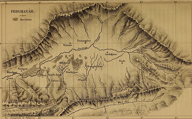
Özgön is located at the far eastern end of the Ferghana Valley,[7] upstream of the point where the Kara-Darya enters the valley. It is 30 miles northeast of Osh, and 20 miles southeast of Jalal-Abad on the banks of the Kara-Darya, on its right side.[8]
Climate
Özgön has a hot summer Mediterranean continental climate (Köppen climate classification Dsa). Summers are hot and dry. Precipitation occurs mostly in winter and its adjacent months.
| Climate data for Özgön (1991-2020) | |||||||||||||
|---|---|---|---|---|---|---|---|---|---|---|---|---|---|
| Month | Jan | Feb | Mar | Apr | May | Jun | Jul | Aug | Sep | Oct | Nov | Dec | Year |
| Daily mean °C (°F) | −1.2 (29.8) |
0.9 (33.6) |
7.5 (45.5) |
13.7 (56.7) |
18.2 (64.8) |
22.4 (72.3) |
24.7 (76.5) |
23.7 (74.7) |
19.2 (66.6) |
12.4 (54.3) |
6.0 (42.8) |
0.6 (33.1) |
12.3 (54.2) |
| Average precipitation mm (inches) | 40.9 (1.61) |
51.2 (2.02) |
77.8 (3.06) |
86.3 (3.40) |
71.9 (2.83) |
38 (1.5) |
19.6 (0.77) |
10.9 (0.43) |
12.6 (0.50) |
54.9 (2.16) |
54.6 (2.15) |
40.7 (1.60) |
559.4 (22.02) |
| Average precipitation days (≥ 0.1 mm) | 7 | 7.4 | 8.6 | 8.1 | 8.7 | 6.4 | 4.4 | 3.1 | 2.9 | 4.9 | 5.7 | 6.1 | 73.3 |
| Average relative humidity (%) | 77.3 | 74.9 | 66.6 | 56.8 | 51.8 | 44.6 | 46.1 | 50 | 52.8 | 60.2 | 69 | 77.9 | 60.7 |
| Source 1: NOAA[9] | |||||||||||||
| Source 2: "The Climate of Uzgen". Weatherbase. Retrieved 31 July 2014. | |||||||||||||
Famous people

- Salizhan Sharipov, born in 1964, astronaut
One of the middle/high schools of Özgön was named after him.
References
External links
Wikiwand in your browser!
Seamless Wikipedia browsing. On steroids.
Every time you click a link to Wikipedia, Wiktionary or Wikiquote in your browser's search results, it will show the modern Wikiwand interface.
Wikiwand extension is a five stars, simple, with minimum permission required to keep your browsing private, safe and transparent.


