Loading AI tools
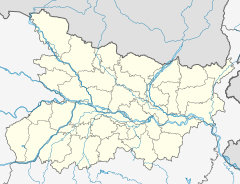
Tilaiya railway station is located in Nawada district in the Indian state of Bihar. Tilaiya railway station is at an elevation of 102 metres (335 ft) and is assigned the station code TIA.[1]
Tilaiya Junction | |||||
|---|---|---|---|---|---|
| Indian Railways junction station | |||||
 | |||||
| General information | |||||
| Location | State Highway 8, Tilaiya, Bihar India | ||||
| Coordinates | 24°49′20″N 85°24′08″E | ||||
| Elevation | 102 metres (335 ft) | ||||
| Owned by | Indian Railways | ||||
| Operated by | East Central Railway zone | ||||
| Line(s) | Gaya–Kiul line Bakhtiyarpur–Tilaiya line Fatuha–Tilaiya line Koderma–Tilaiya line (under construction) | ||||
| Tracks | 5 ft 6 in (1,676 mm) broad gauge | ||||
| Construction | |||||
| Structure type | Standard on ground | ||||
| Parking | Yes | ||||
| Bicycle facilities | Yes | ||||
| Accessible | Yes | ||||
| Other information | |||||
| Status | Functioning and under-construction | ||||
| Station code | TIA | ||||
| Zone(s) | East Central Railway | ||||
| Division(s) | Danapur | ||||
| History | |||||
| Opened | 1879 | ||||
| Rebuilt | 2023 | ||||
| Electrified | 2016–2017 | ||||
| |||||
Gaya was connected to Kiul in 1879 by the South Bihar Railway Company (operated by the East Indian Railway Company).[2][better source needed]
The Bakhtiyarpur–Rajgir line was extended to Tilaiya in 2010.[3]
Feasibility studies for the electrification of the Manpur–Tilaiya–Kiul sector was announced in the rail budget for 2010–11.[4]
Wikiwand in your browser!
Seamless Wikipedia browsing. On steroids.
Every time you click a link to Wikipedia, Wiktionary or Wikiquote in your browser's search results, it will show the modern Wikiwand interface.
Wikiwand extension is a five stars, simple, with minimum permission required to keep your browsing private, safe and transparent.

