Loading AI tools
Bridge that rotates horizontally around a vertical axis From Wikipedia, the free encyclopedia
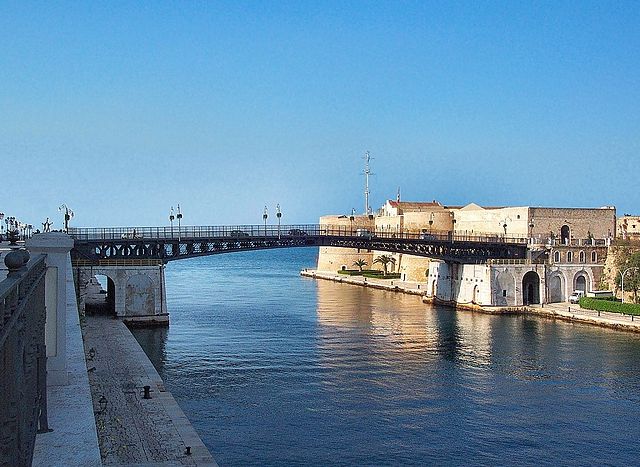
A swing bridge (or swing span bridge) is a movable bridge that can be rotated horizontally around a vertical axis. It has as its primary structural support a vertical locating pin and support ring, usually at or near to its center of gravity, about which the swing span (turning span) can then pivot horizontally as shown in the animated illustration to the right.
This article needs additional citations for verification. (August 2008) |
 | |
| Ancestor | Truss bridge, cantilever bridge |
|---|---|
| Related | Other moving types: Bascule bridge, drawbridge, jetway, vertical-lift bridge, tilt bridge |
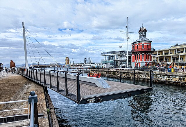
| Descendant | Gate-swing bridge – see Puente de la Mujer |
| Carries | Automobile, truck, light rail, heavy rail |
| Span range | Short |
| Material | Steel |
| Movable | Yes |
| Design effort | Medium |
| Falsework required | No |
In its closed position, a swing bridge carrying a road or railway over a river or canal, for example, allows traffic to cross. When a water vessel needs to pass the bridge, road traffic is stopped (usually by traffic signals and barriers), and then motors rotate the bridge horizontally about its pivot point. The typical swing bridge will rotate approximately 90 degrees, or one-quarter turn; however, a bridge which intersects the navigation channel at an oblique angle may be built to rotate only 45 degrees, or one-eighth turn, in order to clear the channel. Small swing bridges as found over narrow canals may be pivoted only at one end, opening as would a gate, but require substantial underground structure to support the pivot.


| Bridge Name | Waterway | Co-ordinates | Status | Comments |
|---|---|---|---|---|
| Cambie Street Bridge Connaught Bridge | False Creek, Vancouver, British Columbia | 49°16′19″N 123°6′54″W | Demolished/replaced (1985), formerly vehicle, pedestrian & streetcar traffic | Short documentary "Swingspan" tells the history of the bridge and its demolition. |
| Canso Canal Bridge | Canso Canal, Nova Scotia | 45°38′50″N 61°24′45″W | Still swings, Vehicle/Rail Traffic | Links Nova Scotia mainland with Cape Breton Island with 2 traffic lanes of Highway 104 (the Trans-Canada Highway) as well as a single track railway line operated by the Cape Breton and Central Nova Scotia Railway (CBNS). |
| CNR Bridge | Fraser River, British Columbia | 49°11′50″N 122°55′24″W | Still swings, Rail Traffic | Between Queensborough in New Westminster, British Columbia and the mainland |
| Derwent Way Bridge | Fraser River, British Columbia | 49°11′09″N 122°55′55″W | Still swings, Vehicle/Rail Traffic | Between Queensborough in New Westminster, British Columbia and Annacis Island in Delta, British Columbia |
| Fredericton Railway Bridge | Fredericton, New Brunswick | 45°57′25″N 66°37′43″W | No longer swings, pedestrian traffic. | Constructed in 1887 and opened 1889. Last train on the bridge was in 1996. |
| Grand Narrows Bridge | Barra Strait, Bras d'Or Lake, Nova Scotia | 45°57′35.75″N 60°48′1.03″W | Was last opened for marine traffic on December 30, 2014 remaining open for marine traffic since that date, no longer swings, Rail Traffic cannot cross. | Carrying the Cape Breton and Central Nova Scotia Railway (CBNS). |
| Hog's Back Bridge | Rideau Canal, Ottawa, Ontario | 45°22′11″N 75°41′54″W | Still swings, Vehicle Traffic | This bridge swings from one end. There is an adjacent fixed bridge over Hog's Back Falls |
| Iron Bridge | Third Welland Canal, Thorold, Ontario | 43°08′15″N 79°10′38″W | No longer swings, Rail Traffic | Carrying the CNR Grimsby Subdivision over the third Welland Canal. |
| Kaministiquia River Swing Bridge | Kaministiquia River, Thunder Bay, Ontario | 48°21′31″N 89°17′15″W | No longer swings. Road and rail traffic only. Currently closed due to 29 October 2013 fire[1] | Built in 1908 by Grand Trunk Railway; currently owned by the CNR |
| Little Current Swing Bridge | North Channel, Little Current, Ontario | 45°58′48″N 81°54′50″W | Still swings, Vehicle Traffic (formerly rail) | Built by Algoma Eastern Railway, 1913 |
| Montrose Swing Bridge | Welland River, Niagara Falls, Ontario | 43°02′45″N 79°07′11″W | No longer swings, Rail Traffic | Formerly Canada Southern Railway, now CPR |
| Moray Bridge | Middle Arm of the Fraser River, Richmond, British Columbia | 49°11′30″N 123°08′13″W | Still swings; Eastbound Vehicle Traffic | Connects Sea Island, Richmond, BC (location of Vancouver International Airport) to Lulu Island, Richmond, BC |
| New Westminster Bridge | Fraser River, British Columbia | 49°12′29″N 122°53′38″W | Still swings, Rail Traffic, formerly had 2nd deck for vehicles | Between New Westminster and Surrey. |
| Pitt River Bridge | Pitt River, British Columbia | 49°14′52″N 122°43′44″W | No longer swings, Vehicle Traffic | Twin side-by-side bridges connecting Port Coquitlam, British Columbia to Pitt Meadows, British Columbia |
| Pitt River Railway Bridge | Pitt River, British Columbia | 49°14′42″N 122°44′01″W | Still swings – Rail Traffic | (Please Contribute) |
| Wasauksing (Rose Point) Swing Bridge | South Channel, Georgian Bay, near Parry Sound, Ontario | 45°18′54″N 80°2′40″W | Still swings, Vehicle Traffic (formerly rail) | Links Wasauksing First Nation (Parry Island) to the mainland at Rose Point |
| Welland Canal, Bridge 15 | Welland Recreational Waterway, Welland, Ontario | 42°58′37″N 79°15′21″W | No longer swings, Rail Traffic | Built by Canada Southern Railway, c. 1910. Now operated by Trillium Railway |
| Welland Canal, Bridge 20 Approach Span | 2nd and 3rd Welland Canal, Port Colborne, Ontario | 42°53′14″N 79°14′58″W | No longer swings, Abandoned (formerly rail) | Abandoned 1998 when adjacent Vertical-lift bridge was dismantled. |
| Bergen Cut-off Bridge | Red River, Winnipeg, Manitoba | 49°56′49″N 97°5′53″W | Centre span permanently in open position, allowing unrestricted river traffic | Decommissioned CPR railway bridge (last used in 1946) Superstructure built by Dominion Bridge Co. 1913–1914 |
| Pont CN-Du port | Lachine Canal, Montreal, Quebec | 45°29′24.9″N 73°33′26.1″W | No longer swings. | Abandoned CN railway swing bridge in the middle of Lachine Canal. Constructed in 1912 by the Dominion Bridge Company for the Grand Trunk Railway company.[2] The pivot system and the cockpit are still in place, but the bridge has not been operational since the late 1960s.[3] |


Many inner cities have swing bridges, since these require less street space than other types of bridges.
(A "swing bridge" in New Zealand refers to a flexible walking track bridge which "swings" as you walk across.)[9]


In the UK, there is a legal definition in current statute as to what is, or is not a 'swing bridge'[11]


The largest double swing-span bridge in the United States is the 3,250 feet (990 m) long, 450 feet (140 m) navigable span, 60 feet (18 m) clearance George P. Coleman Memorial Bridge.[14]


Omaha NE Turn Style Bridge is now a historical landmark. Located 86H674H5+98 Used for rail transport. Connecting Council Bluffs, Iowa to downtown Omaha, Nebraska

Seamless Wikipedia browsing. On steroids.
Every time you click a link to Wikipedia, Wiktionary or Wikiquote in your browser's search results, it will show the modern Wikiwand interface.
Wikiwand extension is a five stars, simple, with minimum permission required to keep your browsing private, safe and transparent.