Saint-Ursanne
Former municipality in Jura, Switzerland From Wikipedia, the free encyclopedia
Former municipality in Jura, Switzerland From Wikipedia, the free encyclopedia
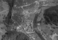
Saint-Ursanne is an old town and a former municipality of the district of Porrentruy in the canton of Jura, Switzerland which has preserved much of its medieval character. The town contains many historical buildings, including a Romanesque abbey church, a collegiate church, a cloister, many medieval houses, a hermitage and an 18th-century bridge. The river Doubs makes a loop near Saint-Ursanne before flowing into France. Since 2009 Saint-Ursanne has been a part of the new municipality Clos du Doubs.[1] An active railway station is located above the town, to the east.
Saint-Ursanne | |
|---|---|
 City gate of Saint-Ursanne | |
 Coat of arms | |
Location of Saint-Ursanne  | |
 Saint-Ursanne  Saint-Ursanne | |
| Coordinates: 47°22′N 7°09′E | |
| Country | Switzerland |
| Canton | Jura |
| District | Porrentruy |
| Area | |
| • Total | 1,146 km2 (442 sq mi) |
| Elevation | 440 m (1,440 ft) |
| Population (2010-12-31) | |
| • Total | 870 |
| • Density | 0.76/km2 (2.0/sq mi) |
| Time zone | UTC+01:00 (Central European Time) |
| • Summer (DST) | UTC+02:00 (Central European Summer Time) |
| Postal code(s) | 2882 |
| SFOS number | 834 |
| ISO 3166 code | CH-JU |
| Surrounded by | Seleute, Ocourt, Montmelon, Asuel, Montenol, Saint-Brais, Epauvillers |
| Twin towns | La Motte, Var (France) |
| Website | www SFSO statistics |
The town is famous for the medieval festival which it organizes each summer,[2] and for the annual St-Ursanne - Les Rangiers International Hill Climb in August.[3][4]
Its name refers to Saint Ursicinus, a seventh-century monk who built a monastery here.
It is important to note that this town received an award as being one of the "best tourism villages" worldwide by UNWTO.


Seamless Wikipedia browsing. On steroids.
Every time you click a link to Wikipedia, Wiktionary or Wikiquote in your browser's search results, it will show the modern Wikiwand interface.
Wikiwand extension is a five stars, simple, with minimum permission required to keep your browsing private, safe and transparent.