Slave Lake
Town in Alberta, Canada From Wikipedia, the free encyclopedia
Slave Lake is a town in northern Alberta, Canada that is surrounded by the Municipal District of Lesser Slave River No. 124. It is approximately 255 km (158 mi) northwest of Edmonton. It is located on the southeast shore of Lesser Slave Lake at the junction of Highway 2 and Highway 88.
Slave Lake | |
|---|---|
Town | |
| Town of Slave Lake | |
 Main street in August 2006 | |
 Town boundaries | |
 Slave Lake Location in the M.D. of Lesser Slave River  Slave Lake Location in Alberta | |
| Coordinates: 55°17′07″N 114°46′14″W | |
| Country | Canada |
| Province | Alberta |
| Region | Northern Alberta |
| Planning region | Upper Athabasca |
| Municipal district | Municipal District of Lesser Slave River No. 124 |
| Incorporated[1] | |
| • Village | January 1, 1961 |
| • Town | August 2, 1965 |
| Government | |
| • Mayor | Francesca Ward |
| • Governing body | Slave Lake Town Council |
| • Interim CAO | Garry Roth |
| • MP | Arnold Viersen (Peace River-Westlock-Cons)[citation needed] |
| • MLA | Scott Sinclair (Lesser Slave Lake-UCP) |
| Area (2021)[3] | |
| • Land | 14.31 km2 (5.53 sq mi) |
| Elevation | 590 m (1,940 ft) |
| Population | |
• Total | 6,836 |
| • Density | 477.7/km2 (1,237/sq mi) |
| Time zone | UTC−7 (MST) |
| • Summer (DST) | UTC−6 (MDT) |
| Postal code span | T0G 2A0 & 2S0 |
| Area code(s) | 780, 587, 825 |
| Highways | Highway 2 Bicentennial Highway |
| Waterways | Lesser Slave Lake Lesser Slave River |
| Website | slavelake.ca |
Slave Lake serves as a local centre for the area. The administrative office for the Sawridge First Nation is also located in the town.
History
Summarize
Perspective
The first European known to visit the area of the present-day Town of Slave Lake was the British explorer David Thompson, who arrived in 1799. Following his brief visit, other British agents established several fur trading posts around Slave Lake, including a Hudson's Bay Company post at the mouth of the lake.
A settlement developed around the post and became known as Sawridge. It was renamed as Slave Lake in 1923. After a flood in the 1930s destroyed much of the town, it was relocated and rebuilt at its current location on higher ground. It was incorporated as a town in 1965.[6]
The Town of Slave Lake was inundated by a flood of Sawridge Creek in July 1988.[7]
2011 wildfire
On May 15, 2011, large parts of the town were affected by wildfires in the area. Winds pushed the flames into town, destroying many houses and businesses. Mandatory evacuation orders were issued, but highways had been closed and residents were urged to seek refuge at beaches, large parking lots, and open spaces.[8][9] Highway 2 had been closed at the outset of the fire, but eventually re-opened for evacuation.[10] Full evacuation of all residents was ordered for Slave Lake.[11]
On May 16, 2011, provincial officials said that 40% of the town had been destroyed or damaged by the fires, including the town hall, the library, a radio station, a mall, and a significant number of homes and other buildings. No injuries or deaths were reported.[12][13][14][15] On May 17, 2011, Mayor Karina Pillay-Kinnee indicated one-third of the town had been destroyed by the wildfire.[16] On May 20, 2011, a firefighting helicopter crashed into the Lesser Slave Lake near Canyon Creek; its pilot died at the scene. It crashed about 30 m (98 ft) off shore into water that was 1.5 m (4.9 ft) deep.[17]
On July 6, Prince William and Catherine, the Duke and Duchess of Cambridge, visited the town to offer encouragement to residents and support for rebuilding efforts.[18]
Geography
Summarize
Perspective
Climate
Slave Lake experiences a subarctic climate (Köppen climate classification Dfc) that borders on a humid continental climate (Köppen Dfb). Summers tend to be mild with cool nights, while winters are long and severely cold.
| Climate data for Slave Lake Airport | |||||||||||||
|---|---|---|---|---|---|---|---|---|---|---|---|---|---|
| Month | Jan | Feb | Mar | Apr | May | Jun | Jul | Aug | Sep | Oct | Nov | Dec | Year |
| Record high °C (°F) | 13.6 (56.5) |
14.8 (58.6) |
17 (63) |
28.6 (83.5) |
32.5 (90.5) |
33.3 (91.9) |
32.2 (90.0) |
32.3 (90.1) |
29.6 (85.3) |
28.1 (82.6) |
19.1 (66.4) |
12.4 (54.3) |
33.3 (91.9) |
| Mean daily maximum °C (°F) | −9.4 (15.1) |
−5.9 (21.4) |
1.2 (34.2) |
9.4 (48.9) |
16.1 (61.0) |
19.3 (66.7) |
21.2 (70.2) |
20.3 (68.5) |
14.6 (58.3) |
9.1 (48.4) |
−1.6 (29.1) |
−8.2 (17.2) |
7.2 (45.0) |
| Daily mean °C (°F) | −14.5 (5.9) |
−11.7 (10.9) |
−4.7 (23.5) |
3.3 (37.9) |
9.7 (49.5) |
13.6 (56.5) |
15.6 (60.1) |
14.6 (58.3) |
9.2 (48.6) |
3.8 (38.8) |
−6.1 (21.0) |
−12.9 (8.8) |
1.7 (35.1) |
| Mean daily minimum °C (°F) | −19.6 (−3.3) |
−17.4 (0.7) |
−10.6 (12.9) |
−2.9 (26.8) |
3.3 (37.9) |
7.9 (46.2) |
10.0 (50.0) |
8.8 (47.8) |
3.7 (38.7) |
−1.5 (29.3) |
−10.5 (13.1) |
−17.7 (0.1) |
−3.9 (25.0) |
| Record low °C (°F) | −42.8 (−45.0) |
−42.5 (−44.5) |
−38.3 (−36.9) |
−26.1 (−15.0) |
−7.2 (19.0) |
−2.7 (27.1) |
2.9 (37.2) |
−2.2 (28.0) |
−7.8 (18.0) |
−21.8 (−7.2) |
−36.1 (−33.0) |
−42.5 (−44.5) |
−42.8 (−45.0) |
| Average precipitation mm (inches) | 24.3 (0.96) |
17.3 (0.68) |
17.7 (0.70) |
21.4 (0.84) |
43.5 (1.71) |
88.2 (3.47) |
95.6 (3.76) |
72.5 (2.85) |
50.8 (2.00) |
27.2 (1.07) |
18.9 (0.74) |
25.2 (0.99) |
502.7 (19.79) |
| Average rainfall mm (inches) | 0.6 (0.02) |
1.0 (0.04) |
1.7 (0.07) |
12.1 (0.48) |
40.9 (1.61) |
88.2 (3.47) |
95.6 (3.76) |
72.4 (2.85) |
48.8 (1.92) |
18.0 (0.71) |
3.1 (0.12) |
2.0 (0.08) |
384.5 (15.14) |
| Average snowfall cm (inches) | 29.9 (11.8) |
21.2 (8.3) |
20.8 (8.2) |
10.4 (4.1) |
2.7 (1.1) |
0.0 (0.0) |
0.0 (0.0) |
0.0 (0.0) |
2.2 (0.9) |
9.7 (3.8) |
19.7 (7.8) |
29.8 (11.7) |
146.5 (57.7) |
| Average precipitation days (≥ 0.2 mm) | 12.0 | 10.0 | 9.2 | 7.1 | 10.5 | 14.1 | 15.0 | 12.6 | 12.6 | 10.0 | 11.3 | 12.9 | 137.3 |
| Average rainy days (≥ 0.2 mm) | 0.9 | 0.9 | 1.6 | 4.3 | 10.1 | 14.1 | 15.0 | 12.6 | 11.9 | 7.3 | 2.6 | 1.2 | 82.5 |
| Average snowy days (≥ 0.2 cm) | 12.5 | 10.2 | 8.6 | 3.6 | 1.0 | 0.0 | 0.0 | 0.0 | 1.0 | 4.5 | 10.1 | 13.0 | 64.5 |
| Average relative humidity (%) (at 3pm) | 76.2 | 71.3 | 64.1 | 51.0 | 47.5 | 55.6 | 59.0 | 59.9 | 60.5 | 59.8 | 73.7 | 77.5 | 63.0 |
| Mean monthly sunshine hours | 80.4 | 112.2 | 173.3 | 234.8 | 281.1 | 277.7 | 294.6 | 260.4 | 167.9 | 141.7 | 84.6 | 63.1 | 2,171.8 |
| Percentage possible sunshine | 33.3 | 41.3 | 47.3 | 55.4 | 56.1 | 53.4 | 56.5 | 56.0 | 43.8 | 43.5 | 33.5 | 28.2 | 45.7 |
| Source: Environment Canada[19] | |||||||||||||
Demographics
Summarize
Perspective
In the 2021 Census of Population conducted by Statistics Canada, the Town of Slave Lake had a population of 6,836 living in 2,405 of its 2,681 total private dwellings, a change of 2.8% from its 2016 population of 6,651. With a land area of 14.31 km2 (5.53 sq mi), it had a population density of 477.7/km2 (1,237.3/sq mi) in 2021.[3]
In the 2016 Census of Population conducted by Statistics Canada, the Town of Slave Lake recorded a population of 6,651 living in 2,329 of its 2,762 total private dwellings, a -1.9% change from its 2011 population of 6,782. With a land area of 14.44 km2 (5.58 sq mi), it had a population density of 460.6/km2 (1,192.9/sq mi) in 2016.[26]
The population of the Town of Slave Lake according to its 2007 municipal census was 7,031.[27]
| Panethnic
group |
2021[28] | 2011[29] | 2001[30] | ||||||
|---|---|---|---|---|---|---|---|---|---|
| Pop. | % | Pop. | % | Pop. | % | ||||
| European[a] | 3,595 | 54.0% | 4,485 | 66.7% | 4,480 | 68.6% | |||
| Indigenous | 1,780 | 26.7% | 1,690 | 25.1% | 1,770 | 27.1% | |||
| Southeast Asian[b] | 730 | 10.9% | 285 | 4.2% | 25 | 0.4% | |||
| South Asian | 215 | 3.2% | 100 | 1.5% | 25 | 0.4% | |||
| Middle Eastern[c] | 185 | 2.8% | 145 | 2.2% | 115 | 1.8% | |||
| African | 90 | 1.4% | 0 | 0.0% | 15 | 0.2% | |||
| East Asian[d] | 30 | 0.5% | 20 | 0.3% | 80 | 1.2% | |||
| Latin American | 15 | 0.2% | 0 | 0.0% | 20 | 0.3% | |||
| Other/Multiracial[e] | 20 | 0.3% | 0 | 0.0% | 0 | 0.0% | |||
| Total responses | 6,660 | 97.4% | 6,725 | 99.2% | 6,530 | 98.9% | |||
| Total population | 6,836 | 100% | 6,782 | 100% | 6,600 | 100% | |||
| Note: Totals greater than 100% due to multiple origin responses | |||||||||
Sports
In 1994, the town hosted the Arctic Winter Games. This is a celebration of circumpolar sports and culture.
| Club | League | Sport | Venue | Established | Championships |
|---|---|---|---|---|---|
| Slave Lake Wolves | Ice Hockey | Arctic Ice Centre | N/A |
1 |
Government
Residents of Slave Lake are in the electoral district of Peace River—Westlock for elections to the House of Commons of Canada, and Lesser Slave Lake for elections to the Legislative Assembly of Alberta.[31][32]
Media
Media outlets serving Slave Lake and surrounding area include BOOM (FM) and the Lakeside Leader, a local community newspaper.
Gallery
 Main Street in 2006
 Main Street in 2006
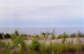 Slave Lake shoreline


See also
Notes
References
External links
Wikiwand - on
Seamless Wikipedia browsing. On steroids.