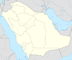
Sinaiyah al-Jadidah (Arabic: مدينة الصناعية الجديدة, lit. 'New Industrial City'), officially Second Industrial City (Arabic: المدينة الصناعية الثانية), is an industrial district in eastern-southernmost Riyadh, Saudi Arabia, located east of al-Misfat and south of Iskan along the al-Kharj Road in the sub-municipality of al-Sulay.[1][2] It was established in 1976 during the reign of King Khalid bin Abdulaziz as part of the second national five-year development plan of 1975–1980.[3] It assumed its current name around 1984[4] and covers an area of 4700 acres. It is overseen by the Saudi Authority for Industrial Cities and Technology Zones (MODON).[5]
Sinaiyah al-Jadidah
الصناعية الجديدة | |
|---|---|
| Second Industrial City | |
 New Industrial City, 2023 | |
| Coordinates: 24°32′40″N 46°53′53″E | |
| Country | Saudi Arabia |
| City | Riyadh |
| Established | 1976 |
| Government | |
| • Body | Al Sulay Sub-Municipality |
| Area | |
• Total | 1,900 ha (4,700 acres) |
| Language | |
| • Official | Arabic |
References
Wikiwand in your browser!
Seamless Wikipedia browsing. On steroids.
Every time you click a link to Wikipedia, Wiktionary or Wikiquote in your browser's search results, it will show the modern Wikiwand interface.
Wikiwand extension is a five stars, simple, with minimum permission required to keep your browsing private, safe and transparent.

