Sibu District
Administrative district in Sarawak, Malaysia From Wikipedia, the free encyclopedia
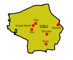
Sibu District is an administrative district in Sibu Division, Sarawak, Malaysia covering a total area of 2229.8 km2.[2] It can be divided into Sibu Town area (129.5 km2)[3] and the rural areas (2,100.3 km2). The satellite township of Sibu Jaya (26 km away from the Sibu city) is included in the rural areas.[4] Sibu District is under the purview of Sibu District Office located at Sibu Islamic Complex, Sibu City. There are currently two local authorities namely Sibu Municipal Council (SMC)[3] and Sibu Rural District Council (SRDC)[5] that administers Sibu City and Sibu rural areas respectively.
Sibu District | |
|---|---|
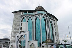
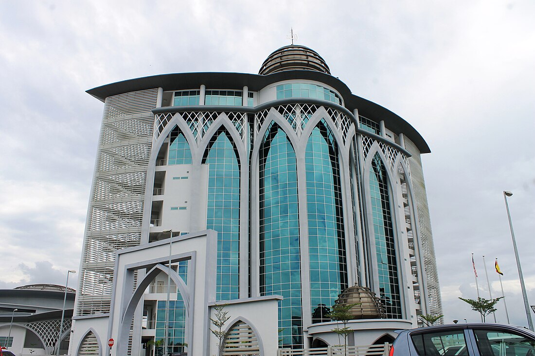
 Sibu District Office is housed inside the Islamic complex. | |
 | |
| District Office location | Sibu |
| Local area government(s) | Sibu Municipal Council (SMC) Sibu Rural District Council (SRDC) |
| Area | |
• Total | 2,229.8 km2 (860.9 sq mi) |
| Population (2024)[1] | |
• Total | 465,163 |
| • Density | 210/km2 (540/sq mi) |
| Chairman | |
| License plate prefix | QS |
| Ethnicity[1] | Chinese (44.9%) Iban (29.8%) Malay (20.6%) Melanau (1.9%) |
| Website | https://smc.gov.my/web/home/ |
Demographics
Summarize
Perspective
This section is empty. You can help by adding to it. (March 2025) |
There has been a marginal growth of Sibu District population of 2.36% from 1991 to 2000. Meanwhile, from 2000 to 2010, there is a marginal growth of 1.53%.[6]
Ethnicity
| Year | Pop. | ±% | ||
|---|---|---|---|---|
| 1975 | 80,375 | — | ||
| 1980 | 98,954 | +23.1% | ||
| 1985 | 120,763 | +22.0% | ||
| 1990 | 151,932 | +25.8% | ||
| 1995 | 190,368 | +25.3% | ||
| 2004 | 229,582 | +20.6% | ||
| 2010 | 301,584 | +31.4% | ||
| 2015 | 364,895 | +21.0% | ||
| 2024 | 465,163 | +27.5% | ||
| ||||
| Source: [7] | ||||
City and towns
Summarize
Perspective
Sibu
James Brooke built a fort in Sibu in 1862.[8] In 1901, 1,118 Fuzhounese settlers migrated to Sibu.[9] Today, Sibu is the largest city by the Rajang River.[10]
Sibu Jaya

Sibu Jaya is located at 26 km away from Sibu.[11] and 1 km away from Sibu Airport. It is a joint development project between AmCorp Corporation Sdn Bhd and Sarawak Housing and Development Corporation.[12] It was developed as a satellite township to Sibu in 1995.[13] The city is expected to be completed in 2023.[12]
Durin
Pesta Rakyat Durin (Durin Peoples' festival) is held at Durin bazaar every year.[14] Durin Bridge connecting the town of Sibu with Durin bazaar was opened in 2006.[15]
Kemuyang
Kemuyang area is located 23 km away from the town of Sibu. Sibu Kemuyang Youth Camp started operation 1999.[16] Sibu Pastoral Centre is also located here.[17]
Rantau Panjang
Rantau Panjang Integrated Shipyard Shipbuilding Industrial Zone was constructed in 2003.[18]
Pasai Siong
The largest Covid-19 cluster in Sarawak was detected here. The cluster lasted from December 2020 to April 2021, infecting a total of 2,693 people across ten other districts in Sarawak, resulting in 29 deaths.[19]
Climate
| Climate data for Sibu (1991–2020 normals) | |||||||||||||
|---|---|---|---|---|---|---|---|---|---|---|---|---|---|
| Month | Jan | Feb | Mar | Apr | May | Jun | Jul | Aug | Sep | Oct | Nov | Dec | Year |
| Record high °C (°F) | 35.1 (95.2) |
34.8 (94.6) |
35.6 (96.1) |
35.7 (96.3) |
36.6 (97.9) |
36.5 (97.7) |
37.1 (98.8) |
36.6 (97.9) |
36.5 (97.7) |
36.2 (97.2) |
34.8 (94.6) |
35.3 (95.5) |
37.1 (98.8) |
| Mean daily maximum °C (°F) | 31.0 (87.8) |
31.4 (88.5) |
32.3 (90.1) |
32.8 (91.0) |
32.9 (91.2) |
32.7 (90.9) |
32.8 (91.0) |
32.8 (91.0) |
32.3 (90.1) |
32.1 (89.8) |
32.0 (89.6) |
31.5 (88.7) |
32.2 (90.0) |
| Daily mean °C (°F) | 26.0 (78.8) |
26.1 (79.0) |
26.6 (79.9) |
26.9 (80.4) |
27.2 (81.0) |
27.0 (80.6) |
26.9 (80.4) |
26.9 (80.4) |
26.6 (79.9) |
26.4 (79.5) |
26.4 (79.5) |
26.2 (79.2) |
26.6 (79.9) |
| Mean daily minimum °C (°F) | 23.2 (73.8) |
23.2 (73.8) |
23.4 (74.1) |
23.6 (74.5) |
23.8 (74.8) |
23.6 (74.5) |
23.3 (73.9) |
23.3 (73.9) |
23.2 (73.8) |
23.3 (73.9) |
23.3 (73.9) |
23.3 (73.9) |
23.4 (74.1) |
| Record low °C (°F) | 18.5 (65.3) |
19.5 (67.1) |
20.0 (68.0) |
21.5 (70.7) |
21.6 (70.9) |
21.0 (69.8) |
20.5 (68.9) |
20.2 (68.4) |
20.9 (69.6) |
20.8 (69.4) |
21.4 (70.5) |
21.0 (69.8) |
18.5 (65.3) |
| Average precipitation mm (inches) | 440.2 (17.33) |
337.3 (13.28) |
336.1 (13.23) |
292.8 (11.53) |
242.7 (9.56) |
219.6 (8.65) |
179.5 (7.07) |
222.4 (8.76) |
230.5 (9.07) |
276.2 (10.87) |
362.2 (14.26) |
417.8 (16.45) |
3,557.2 (140.05) |
| Average precipitation days (≥ 1.0 mm) | 20.7 | 15.6 | 16.4 | 16.4 | 15.5 | 13.0 | 11.8 | 13.0 | 14.8 | 18.3 | 20.1 | 21.1 | 196.7 |
| Mean monthly sunshine hours | 133 | 132 | 152 | 175 | 190 | 183 | 198 | 176 | 145 | 163 | 162 | 149 | 1,958 |
| Source 1: World Meteorological Organization[20] | |||||||||||||
| Source 2: Ogimet[21] | |||||||||||||
References
Wikiwand - on
Seamless Wikipedia browsing. On steroids.

