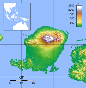
Selong is a town and administrative district (kecamatan) on the island of Lombok which serves as the capital of the East Lombok Regency in the Indonesian province of West Nusa Tenggara.
Selong | |
|---|---|
Town/City | |
 Road sign at a market near Selong (1949) | |
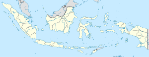
Location in Indonesia | |
| Coordinates: 8°39′S 116°32′E | |
| Country | Indonesia |
| Region | Lesser Sunda Islands |
| Province | West Nusa Tenggara |
| Regency | East Lombok |
| Area | |
| • Total | 31.68 km2 (12.23 sq mi) |
| Population (mid 2023 estimate) | |
| • Total | 96,015 |
| • Density | 3,000/km2 (7,800/sq mi) |
| [1] | |
| Time zone | UTC+08 |
Climate
Selong has a tropical savanna climate (Aw) with little to no rainfall from April to November and heavy rainfall from December to March.
| Climate data for Selong | |||||||||||||
|---|---|---|---|---|---|---|---|---|---|---|---|---|---|
| Month | Jan | Feb | Mar | Apr | May | Jun | Jul | Aug | Sep | Oct | Nov | Dec | Year |
| Mean daily maximum °C (°F) | 29.6 (85.3) |
29.6 (85.3) |
29.9 (85.8) |
30.4 (86.7) |
30.0 (86.0) |
29.3 (84.7) |
28.9 (84.0) |
29.4 (84.9) |
30.1 (86.2) |
30.4 (86.7) |
30.1 (86.2) |
29.8 (85.6) |
29.8 (85.6) |
| Daily mean °C (°F) | 25.6 (78.1) |
25.7 (78.3) |
25.7 (78.3) |
25.6 (78.1) |
25.0 (77.0) |
24.1 (75.4) |
23.6 (74.5) |
24.0 (75.2) |
24.9 (76.8) |
25.5 (77.9) |
25.8 (78.4) |
25.7 (78.3) |
25.1 (77.2) |
| Mean daily minimum °C (°F) | 21.7 (71.1) |
21.8 (71.2) |
21.5 (70.7) |
20.8 (69.4) |
20.1 (68.2) |
19.0 (66.2) |
18.4 (65.1) |
18.7 (65.7) |
19.7 (67.5) |
20.6 (69.1) |
21.5 (70.7) |
21.6 (70.9) |
20.5 (68.8) |
| Average rainfall mm (inches) | 254 (10.0) |
166 (6.5) |
146 (5.7) |
52 (2.0) |
36 (1.4) |
8 (0.3) |
38 (1.5) |
15 (0.6) |
5 (0.2) |
29 (1.1) |
84 (3.3) |
215 (8.5) |
1,048 (41.1) |
| Source: Climate-Data.org[2] | |||||||||||||
References
Wikiwand in your browser!
Seamless Wikipedia browsing. On steroids.
Every time you click a link to Wikipedia, Wiktionary or Wikiquote in your browser's search results, it will show the modern Wikiwand interface.
Wikiwand extension is a five stars, simple, with minimum permission required to keep your browsing private, safe and transparent.


