Sarabetsu, Hokkaido
Village in Hokkaido, Japan From Wikipedia, the free encyclopedia
Sarabetsu (更別村, Sarabetsu-mura) is a village located in Tokachi Subprefecture, Hokkaido, Japan.
This article has multiple issues. Please help improve it or discuss these issues on the talk page. (Learn how and when to remove these messages)
|
Sarabetsu
更別村 | |
|---|---|
Village | |
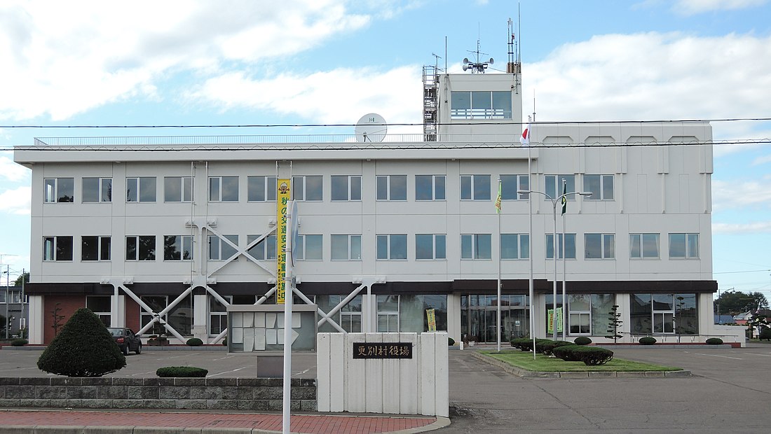
 Sarabetsu Village hall | |
 Location of Sarabetsu in Hokkaido (Tokachi Subprefecture) | |
| Coordinates: 42°39′N 143°11′E | |
| Country | Japan |
| Region | Hokkaido |
| Prefecture | Hokkaido (Tokachi Subprefecture) |
| District | Kasai |
| Area | |
• Total | 176.45 km2 (68.13 sq mi) |
| Population (September 30, 2016) | |
• Total | 3,275 |
| • Density | 19/km2 (48/sq mi) |
| Time zone | UTC+09:00 (JST) |
| Climate | Dfb |
| Website | www |
Population
As of September 2016, the village has an estimated population of 3,275. The total area is 176.45 km2.
Climate
| Climate data for Sarabetsu (1991−2020 normals, extremes 1977−present) | |||||||||||||
|---|---|---|---|---|---|---|---|---|---|---|---|---|---|
| Month | Jan | Feb | Mar | Apr | May | Jun | Jul | Aug | Sep | Oct | Nov | Dec | Year |
| Record high °C (°F) | 7.6 (45.7) |
10.9 (51.6) |
15.7 (60.3) |
29.6 (85.3) |
38.0 (100.4) |
34.9 (94.8) |
36.2 (97.2) |
37.1 (98.8) |
34.2 (93.6) |
27.5 (81.5) |
21.3 (70.3) |
14.0 (57.2) |
38.0 (100.4) |
| Mean daily maximum °C (°F) | −2.7 (27.1) |
−1.7 (28.9) |
2.9 (37.2) |
10.3 (50.5) |
16.5 (61.7) |
19.4 (66.9) |
22.7 (72.9) |
24.0 (75.2) |
20.8 (69.4) |
15.0 (59.0) |
7.5 (45.5) |
−0.1 (31.8) |
11.2 (52.2) |
| Daily mean °C (°F) | −8.7 (16.3) |
−7.7 (18.1) |
−2.2 (28.0) |
4.7 (40.5) |
10.6 (51.1) |
14.1 (57.4) |
17.8 (64.0) |
19.1 (66.4) |
15.8 (60.4) |
9.3 (48.7) |
2.4 (36.3) |
−5.5 (22.1) |
5.8 (42.4) |
| Mean daily minimum °C (°F) | −15.4 (4.3) |
−15.0 (5.0) |
−8.4 (16.9) |
−0.6 (30.9) |
5.0 (41.0) |
9.6 (49.3) |
14.0 (57.2) |
15.4 (59.7) |
11.4 (52.5) |
4.1 (39.4) |
−2.7 (27.1) |
−11.5 (11.3) |
0.5 (32.9) |
| Record low °C (°F) | −26.9 (−16.4) |
−29.0 (−20.2) |
−25.8 (−14.4) |
−13.0 (8.6) |
−4.4 (24.1) |
0.6 (33.1) |
6.0 (42.8) |
6.8 (44.2) |
0.5 (32.9) |
−5.7 (21.7) |
−15.4 (4.3) |
−22.7 (−8.9) |
−29.0 (−20.2) |
| Average precipitation mm (inches) | 56.9 (2.24) |
42.4 (1.67) |
58.8 (2.31) |
71.6 (2.82) |
95.8 (3.77) |
96.0 (3.78) |
119.7 (4.71) |
157.3 (6.19) |
179.5 (7.07) |
118.4 (4.66) |
76.8 (3.02) |
67.5 (2.66) |
1,137.9 (44.80) |
| Average precipitation days (≥ 1.0 mm) | 6.9 | 5.9 | 8.0 | 8.2 | 8.7 | 8.8 | 9.7 | 10.9 | 10.8 | 8.9 | 8.6 | 7.5 | 102.9 |
| Mean monthly sunshine hours | 147.9 | 149.2 | 186.6 | 186.4 | 176.0 | 140.7 | 120.6 | 123.4 | 138.5 | 168.4 | 155.8 | 135.5 | 1,828.6 |
| Source: JMA[1][2] | |||||||||||||
Mascot

Sarabetsu's mascot is Don-chan (しばれ君). He is an acorn. His goal is to have the town develop like a tree.[3]
References
External links
Wikiwand - on
Seamless Wikipedia browsing. On steroids.


