Top Qs
Timeline
Chat
Perspective
San Ramón (canton)
Canton in Alajuela province, Costa Rica From Wikipedia, the free encyclopedia
Remove ads
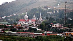
San Ramón is a canton (administrative district, similar to "County") in the Alajuela province of Costa Rica.[3][4] The head city is in San Ramón district.
Remove ads
Remove ads
History
San Ramón was created on 21 August 1856 by decree 17.[2]
Geography
San Ramón has an area of 1,018.64 km²[5] and a mean elevation of 974 metres.[3]
An oddly-shaped canton, San Ramon stretches north through the eastern heights of the Cordillera de Tilarán, looking down on the Central Valley (Valle Central) to its east. The canton forms the border with the province of Guanacaste to the west.
Districts
The canton of San Ramón is subdivided into the following districts:
Demographics
For the 2011 census, San Ramón had a population of 80,566 inhabitants. [8]
For the 2022 census, San Ramón had a population of 93,264 inhabitants, demonstrating the canton's steady growth.[9]
Remove ads
Transportation
Road transportation
The canton is covered by the following road routes:
References
Wikiwand - on
Seamless Wikipedia browsing. On steroids.
Remove ads


