Saint-Eugène, Quebec
Municipality in Quebec, Canada From Wikipedia, the free encyclopedia
Saint-Eugène (French pronunciation: [sɛ̃t‿øʒɛn]) is a municipality in the Centre-du-Québec region of Quebec. The population as of the Canada 2021 Census was 1,139.
Saint-Eugène | |
|---|---|
 Loisirs Road | |
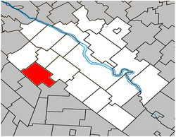
 Location within Drummond RCM. | |
| Coordinates: 45°48′N 72°42′W[1] | |
| Country | Canada |
| Province | Quebec |
| Region | Centre-du-Québec |
| RCM | Drummond |
| Constituted | October 31, 1879 |
| Government | |
| • Mayor | Gilles Beauregard |
| • Federal riding | Drummond |
| • Prov. riding | Johnson |
| Area | |
• Total | 76.20 km2 (29.42 sq mi) |
| • Land | 75.84 km2 (29.28 sq mi) |
| Population | |
• Total | 1,139 |
| • Density | 15.0/km2 (39/sq mi) |
| • Pop 2016-2021 | 1.2% |
| • Dwellings | 536 |
| Time zone | UTC−5 (EST) |
| • Summer (DST) | UTC−4 (EDT) |
| Postal code(s) | |
| Area code | 819 |
| Highways A-20 (TCH) | R-239 |
| Website | www |
Demographics
Population
Population trend:[5]
| Census | Population | Change (%) |
|---|---|---|
| 2021 | 1,139 | |
| 2016 | 1,126 | |
| 2011 | 1,131 | |
| 2006 | 1,133 | |
| 2001 | 1,084 | |
| 1996 | 1,058 | |
| 1991 | 982 | |
| 1986 | 955 | |
| 1981 | 953 | |
| 1976 | 938 | |
| 1971 | 996 | |
| 1966 | 982 | |
| 1961 | 1,003 | |
| 1956 | 1,017 | |
| 1951 | 928 | |
| 1941 | 877 | |
| 1931 | 900 | |
| 1921 | 1,135 | |
| 1911 | 1,120 | |
| 1901 | 824 | |
| 1891 | 1,049 | |
| 1881 | 520 | N/A |
Language
Mother tongue language (2021)[6]
| Language | Population | Pct (%) |
|---|---|---|
| French only | 1,110 | 97.4% |
| English only | 10 | 0.9% |
| Both English and French | 10 | 0.9% |
| Other languages | 10 | 0.9% |
See also
References
Wikiwand - on
Seamless Wikipedia browsing. On steroids.

