Roya (river)
River in France and Italy From Wikipedia, the free encyclopedia
The Roya (French, [ʁwaja]), Roia (Italian), or Ròia (Brigasc, Occitan) is a river of France and Italy, discharging into the Ligurian Sea. It is 59 km (37 mi) long, of which 40.1 km (24.9 mi) in France.[1] Its drainage basin is about 660 km2 (250 sq mi), of which 601 km2 (232 sq mi) in France.[2]

| Roya Roia, Roja | |
|---|---|
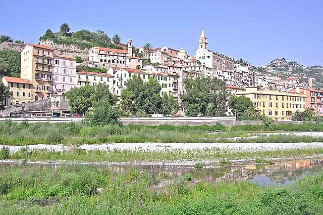
 The river at Ventimiglia | |
 | |
| Location | |
| Countries | France and Italy |
| Physical characteristics | |
| Source | |
| • location | Colle di Tenda near Tende, France. |
| • elevation | 1,908 m (6,260 ft) |
| Mouth | |
• location | Ligurian Sea at Ventimiglia, Italy |
• coordinates | 43°47′17″N 7°36′22″E |
• elevation | 0 m (0 ft) |
| Length | 59 km (37 mi) |
| Basin size | 660 km2 (250 sq mi) |
| Discharge | |
| • average | 15 m3/s (530 cu ft/s) |
River course
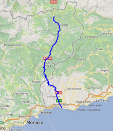
The river rises in French territory near the Col de Tende and flows through the Mercantour National Park. The river passes through the communes of Tende, Saorge, Breil-sur-Roya, La Brigue, before entering Italy in the commune of Olivetta San Michele. The remainder of its course remains within the province of Imperia and, after crossing Airole the river enters the sea at Ventimiglia.[3]
Its main tributaries are the Lévensa, the Bévéra, the Bendola, the Réfréi and the Maglia.
References
Wikiwand in your browser!
Seamless Wikipedia browsing. On steroids.
Every time you click a link to Wikipedia, Wiktionary or Wikiquote in your browser's search results, it will show the modern Wikiwand interface.
Wikiwand extension is a five stars, simple, with minimum permission required to keep your browsing private, safe and transparent.
