Romeo, Colorado
Town in Colorado, United States From Wikipedia, the free encyclopedia
Romeo is a Statutory Town in Conejos County, Colorado, United States. The population was 302 at the 2020 census.[5] A post office called Romeo was established in 1901.[7] The community derives its name from the surname Romero.[8]
Town of Romeo, Colorado | |
|---|---|
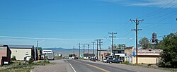
 Main Street, looking west | |
 Location of Romeo in Conejos County, Colorado. | |
| Coordinates: 37°10′19″N 105°59′07″W | |
| Country | United States |
| State | Colorado |
| County[1] | Conejos County[2] |
| Incorporated (town) | September 4, 1923[3] |
| Government | |
| • Type | Statutory Town[1] |
| Area | |
| • Total | 0.23 sq mi (0.60 km2) |
| • Land | 0.23 sq mi (0.60 km2) |
| • Water | 0.00 sq mi (0.00 km2) |
| Elevation | 7,737 ft (2,358 m) |
| Population | |
| • Total | 302 |
| • Density | 1,300/sq mi (500/km2) |
| Time zone | UTC-7 (Mountain (MST)) |
| • Summer (DST) | UTC-6 (MDT) |
| ZIP code[6] | 81148 |
| Area code | 719 |
| FIPS code | 08-65740 |
| GNIS feature ID | 2412574[2] |
Geography
Romeo is located in east-central Conejos County in the San Luis Valley region. U.S. Route 285 runs along the western border of the town, leading north 21 miles (34 km) to Alamosa and south 12 miles (19 km) to the New Mexico border and beyond. Colorado State Highway 142 is the town's Main Street, with its western terminus at U.S. 285 and leading east 3 miles (5 km) to Manassa and 32 miles (51 km) to San Luis.
According to the United States Census Bureau, the town has a total area of 0.2 square miles (0.52 km2), all of it land.
Demographics
See also
References
External links
Wikiwand in your browser!
Seamless Wikipedia browsing. On steroids.
Every time you click a link to Wikipedia, Wiktionary or Wikiquote in your browser's search results, it will show the modern Wikiwand interface.
Wikiwand extension is a five stars, simple, with minimum permission required to keep your browsing private, safe and transparent.
