Rangárþing eystra
Municipality in Southern Region, Iceland From Wikipedia, the free encyclopedia
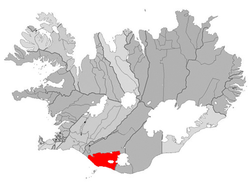
Rangárþing eystra (Icelandic pronunciation: [ˈrauŋkˌaurˌθiŋk ˌeistra] ⓘ) is a municipality located in southern Iceland in the Southern Region, between Eystri Rangá in the west and Jökulsá á Sólheimasandi in the east. The largest settlements are Skógar and Hvolsvöllur.
Rangárþing eystra | |
|---|---|
 Location of Rangárþing eystra | |
| Country | Iceland |
| Region | Southern Region |
| Constituency | South Constituency |
| Government | |
| • Mayor | Anton Kári Halldórsson |
| Area | |
• Total | 1,832 km2 (707 sq mi) |
| Population (2024)[1] | |
• Total | 2,007 |
| • Density | 1.1/km2 (2.8/sq mi) |
| Postal code(s) | 860, 861 |
| Municipal number | 8613 |
| Website | hvolsvollur |
References
External links
Wikiwand - on
Seamless Wikipedia browsing. On steroids.

