Gurabo River
River of Puerto Rico From Wikipedia, the free encyclopedia
The Gurabo River (Spanish: Río Gurabo) is a river and tributary of the Loíza River in Puerto Rico. In 2018, the U.S. Army Corps of Engineers announced work would be done on the river,[2] which runs through several municipalities including Gurabo, Juncos, and Las Piedras.[1]
| Gurabo River | |
|---|---|
 | |
 | |
| Native name | Río Gurabo (Spanish) |
| Location | |
| Commonwealth | Puerto Rico |
| Municipality | Gurabo, Juncos, Las Piedras |
| Physical characteristics | |
| Source | |
| • location | El Río, Las Piedras |
| • coordinates | 18.2716200°N 66.0082205°W[1] |
| Mouth | |
• location | Loíza River in Jaguas, Gurabo |
In 2018, homes in Juncos were on the verge of collapse as a result of erosion and landslides caused by a change in the rivers trajectory.[3]
Gallery
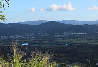 View of Gurabo River

See also
References
External links
Wikiwand - on
Seamless Wikipedia browsing. On steroids.