Loading AI tools
Village in Northern Hungary, Hungary From Wikipedia, the free encyclopedia
Poroszló is a village in Heves County, Northern Hungary Region, Hungary.
Poroszló | |
|---|---|
Village (község) | |
 City hall of Poroszló | |
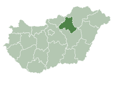
 Location of Heves County in Hungary | |
Location of Poroszló in Hungary | |
| Coordinates: 47°38′49″N 20°39′07″E | |
| Country | |
| Region | Northern Hungary |
| County | Heves County |
| Subregion | Füzesabony |
| Government | |
| • Mayor | János Bornemisza |
| Area | |
| • Total | 109.04 km2 (42.10 sq mi) |
| Elevation | 89 m (292 ft) |
| Population (2017) | |
| • Total | 2,882[1] |
| Time zone | UTC+1 (CET) |
| • Summer (DST) | UTC+2 (CEST) |
| Postal code | 3388 |
| Area code | 36 |
| Website | http://poroszlo.hu/ |
Poroszló's climate is classified as humid continental climate (Köppen Dfa). The annual average temperature is 10.8 °C (51.4 °F), the hottest month in July is 22.0 °C (71.6 °F), and the coldest month is −1.4 °C (29.5 °F) in January. The annual precipitation is 562.0 millimetres (22.13 in), of which July is the wettest with 79.1 millimetres (3.11 in), while January is the driest with only 26.4 millimetres (1.04 in). The extreme temperature throughout the year ranged from −22.6 °C (−8.7 °F) on January 12, 2003 to 39.5 °C (103.1 °F) on July 20, 2007.
| Climate data for Poroszló, 1991−2020 normals | |||||||||||||
|---|---|---|---|---|---|---|---|---|---|---|---|---|---|
| Month | Jan | Feb | Mar | Apr | May | Jun | Jul | Aug | Sep | Oct | Nov | Dec | Year |
| Record high °C (°F) | 15.3 (59.5) |
18.9 (66.0) |
23.7 (74.7) |
30.9 (87.6) |
34.1 (93.4) |
36.1 (97.0) |
39.5 (103.1) |
37.6 (99.7) |
35.1 (95.2) |
27.4 (81.3) |
22.2 (72.0) |
14.8 (58.6) |
39.5 (103.1) |
| Mean daily maximum °C (°F) | 1.7 (35.1) |
4.8 (40.6) |
11.1 (52.0) |
17.8 (64.0) |
22.7 (72.9) |
26.3 (79.3) |
28.4 (83.1) |
28.3 (82.9) |
22.6 (72.7) |
16.3 (61.3) |
8.9 (48.0) |
2.6 (36.7) |
16.0 (60.8) |
| Daily mean °C (°F) | −1.4 (29.5) |
0.6 (33.1) |
5.7 (42.3) |
11.6 (52.9) |
16.7 (62.1) |
20.2 (68.4) |
22.0 (71.6) |
21.7 (71.1) |
16.4 (61.5) |
10.7 (51.3) |
5.1 (41.2) |
−0.1 (31.8) |
10.8 (51.4) |
| Mean daily minimum °C (°F) | −3.9 (25.0) |
−2.8 (27.0) |
0.8 (33.4) |
5.5 (41.9) |
10.6 (51.1) |
14.0 (57.2) |
15.6 (60.1) |
15.3 (59.5) |
11.1 (52.0) |
6.2 (43.2) |
2.0 (35.6) |
−2.7 (27.1) |
6.0 (42.8) |
| Record low °C (°F) | −22.6 (−8.7) |
−20.0 (−4.0) |
−15.0 (5.0) |
−6.7 (19.9) |
−2.4 (27.7) |
4.3 (39.7) |
7.1 (44.8) |
6.4 (43.5) |
0.0 (32.0) |
−9.9 (14.2) |
−11.8 (10.8) |
−21.4 (−6.5) |
−22.6 (−8.7) |
| Average precipitation mm (inches) | 26.4 (1.04) |
32.8 (1.29) |
29.3 (1.15) |
40.5 (1.59) |
57.7 (2.27) |
61.1 (2.41) |
79.1 (3.11) |
54.4 (2.14) |
52.8 (2.08) |
47.5 (1.87) |
41.4 (1.63) |
39.0 (1.54) |
562.0 (22.13) |
| Average precipitation days (≥ 1.0 mm) | 5.8 | 6.3 | 5.7 | 6.5 | 8.0 | 8.4 | 8.2 | 6.4 | 6.9 | 6.4 | 6.8 | 7.2 | 82.6 |
| Average relative humidity (%) | 85.8 | 80.6 | 70.8 | 64.6 | 66.7 | 67.1 | 66.2 | 66.1 | 71.9 | 79.7 | 86.2 | 87.6 | 74.4 |
| Source: NOAA[2] | |||||||||||||
Seamless Wikipedia browsing. On steroids.
Every time you click a link to Wikipedia, Wiktionary or Wikiquote in your browser's search results, it will show the modern Wikiwand interface.
Wikiwand extension is a five stars, simple, with minimum permission required to keep your browsing private, safe and transparent.