Oxbow, Oregon
Unincorporated community in the state of Oregon, United States From Wikipedia, the free encyclopedia
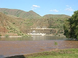
Oxbow is an unincorporated community in Baker County, Oregon, United States.[1] Oxbow is along Oregon Route 86 next to the Snake River near the Oxbow Dam on the Oregon-Idaho border, about 17 miles (27 km) northeast of Halfway.[2] Oxbow is just south of the site of the former mining town of Copperfield.[2] Oxbow has a post office with a ZIP code 97840.[3]
There was once a station named Oxbow on a portion of the Oregon Short Line Railroad now inundated by Oxbow Reservoir.[4][5] It was named for The Oxbow, a U-shaped bend in the Snake River named for the agricultural implement.[4][6] The present-day community of Oxbow was established in the early 1960s near the former site of Copperfield during the building of the Oxbow Dam by the Idaho Power Company.[4] Oxbow post office was established on May 1, 1965, after moving the office from Homestead six miles to the north.[4] At one time, Oxbow had a school.[7]
Climate
This region experiences warm (but not hot) and dry summers, with no average monthly temperatures above 71.6 °F (22 °C). According to the Köppen Climate Classification system, Oxbow has a warm-summer Mediterranean climate, abbreviated "Csb" on climate maps.[8]
References
External links
Wikiwand in your browser!
Seamless Wikipedia browsing. On steroids.
Every time you click a link to Wikipedia, Wiktionary or Wikiquote in your browser's search results, it will show the modern Wikiwand interface.
Wikiwand extension is a five stars, simple, with minimum permission required to keep your browsing private, safe and transparent.


