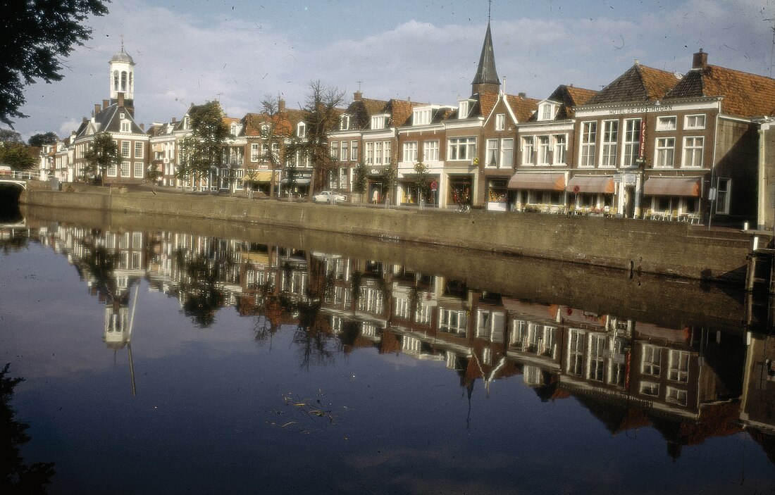
Dongeradeel (Dutch: [ˈdɔŋəraːˌdeːl] ; West Frisian: Dongeradiel ()) is a former municipality in the northern Netherlands. In 2019 it merged with the municipalities of Ferwerderadiel and Kollumerland en Nieuwkruisland to form the new municipality Noardeast-Fryslân.
Dongeradeel
Dongeradiel | |
|---|---|
 Canal through Dokkum | |
 Location in Friesland | |
| Coordinates: 53°20′N 6°0′E | |
| Country | Netherlands |
| Province | Friesland |
| Established | 1 January 1984 |
| Merged | 2019 |
| Area | |
| • Total | 266.92 km2 (103.06 sq mi) |
| • Land | 167.21 km2 (64.56 sq mi) |
| • Water | 99.71 km2 (38.50 sq mi) |
| Elevation | 4 m (13 ft) |
| Population (January 2021)[3] | |
| • Total | data missing |
| Time zone | UTC+1 (CET) |
| • Summer (DST) | UTC+2 (CEST) |
| Postcode | 9100–9156 |
| Area code | 0519 |
| Website | www |
History
Dongeradeel was created in 1984 from the merging of the old municipalities Westdongeradeel, Oostdongeradeel, and Dokkum.
Population centres
Aalsum, Anjum, Bornwird, Brantgum, Dokkum, Ee, Engwierum, Foudgum, Hantum, Hantumeruitburen, Hantumhuizen, Hiaure, Holwerd, Jouswier, Lioessens, Metslawier, Moddergat, Morra, Nes, Niawier, Oosternijkerk, Oostmahorn, Oostrum, Paesens, Raard, Ternaard, Waaxens, Wetsens, Wierum.
Topography
Dutch Topographic map of the municipality of Dongeradeel, June 2015.
Notable people


- Ritske Jelmera (1383 in Ternaard - 1450) a Frisian chieftain who ruled the island of Ameland
- Johannes Phocylides Holwarda (1618 in Holwerd — 1651) a Frisian astronomer, physician, philosopher and academic
- Hans Willem van Aylva (ca.1633 in Holwerd - 1691) a Dutch soldier
- Balthasar Bekker (1634 in Metslawier – 1698) a Dutch minister and author of philosophical and theological works opposing superstition
- Nienke van Hichtum (1860 in Nes, Dongeradeel – 1939) a Frisian Dutch children's author
- Willem van der Woude (1876 in Oosternijkerk – 1974) a Dutch mathematician and academic
- Meindert DeJong (1906 in Wierum – 1991) a Dutch-born American writer of children's books
- Lou Dijkstra (1909 in Paesens – 1964) a Dutch speed skater, competed in the 1936 Winter Olympics
- Theo Hiddema (born 1944 in Holwerd) a Dutch lawyer, media personality and politician
- Sybe I. Rispens (born 1969 in Dokkum) a Dutch writer, scientist and entrepreneur
References
External links
Wikiwand in your browser!
Seamless Wikipedia browsing. On steroids.
Every time you click a link to Wikipedia, Wiktionary or Wikiquote in your browser's search results, it will show the modern Wikiwand interface.
Wikiwand extension is a five stars, simple, with minimum permission required to keep your browsing private, safe and transparent.


