Nikolayevsk-on-Amur
Town in Khabarovsk Krai, Russia From Wikipedia, the free encyclopedia

Nikolayevsk-on-Amur (Russian: Никола́евск-на-Аму́ре, romanized: Nikoláyevsk-na-Amúrye) is a town in Khabarovsk Krai, Russia located on the Amur River close to its liman in the Pacific Ocean. Population: 17,815 (2024);[9] 22,752 (2010 Census);[2] 28,492 (2002 Census);[10] 36,296 (1989 Soviet census).[11]
Nikolayevsk-on-Amur
Николаевск-на-Амуре | |
|---|---|
 | |
_new.png) Flag _(2002).png) Coat of arms | |
Location of Nikolayevsk-on-Amur  | |
 Nikolayevsk-on-Amur Location of Nikolayevsk-on-Amur  Nikolayevsk-on-Amur Nikolayevsk-on-Amur (Khabarovsk Krai) | |
| Coordinates: 53°08′N 140°44′E | |
| Country | Russia |
| Federal subject | Khabarovsk Krai[1] |
| Founded | 13 August 1850 |
| Town status since | 1856 |
| Government | |
| • Head | Anton Leonov |
| Elevation | 30 m (100 ft) |
| Population | |
• Total | 22,752 |
| • Subordinated to | town of krai significance of Nikolayevsk-on-Amur[1] |
| • Capital of | town of krai significance of Nikolayevsk-on-Amur,[3] Nikolayevsky District[4] |
| • Municipal district | Nikolayevsky Municipal District[5] |
| • Urban settlement | Nikolayevsk-na-Amure Urban Settlement[5] |
| • Capital of | Nikolayevsky Municipal District,[6] Nikolayevsk-na-Amure Urban Settlement |
| Time zone | UTC+10 (MSK+7 [7]) |
| Postal code(s)[8] | 682460 |
| Dialing code(s) | +7 42135 |
| OKTMO ID | 08631101001 |
History
Summarize
Perspective
Medieval and early-modern history
In the late Middle Ages, the people living along the lower course of the Amur (Nivkh, Oroch, Evenki) were collectively known in China as the "wild Jurchen". The Yuan dynasty Mongols sent expeditions to this area with an eye toward using the region as a base for attack on Japan, or for defending against the Sakhalin Ainus. According to the History of Yuan, in 1264 the Nivkhs recognized the Mongol sovereignty. In 1263, the Mongols set up the "Command Post of the Marshal of the Eastern Campaign" near the modern settlement of Tyr, some 100 kilometers (62 mi) upstream from today's Nikolayevsk-on-Amur. At roughly the same time, a shrine was built on the Tyr Rock.[12][13]
From 1411 to 1433, the Ming eunuch Yishiha, a man of Haixi Jurchen origin, led four large missions to win over the allegiance of the "Jurchen" tribes along the Sunggari and Amur Rivers. During this time, the Yongning Temple was constructed at Tyr, and stelae with inscriptions erected.[12]
Russian period

The Russian settlement, likely preceded by the Manchu village of Fuyori,[14] was founded as Nikolayevsky Post by Gennady Nevelskoy on 13 August 1850[citation needed] and named for Tsar Nicholas I.[15]
The settlement quickly became one of the main economic centres on the Pacific coast of the Russian Empire. It became Russia's main Pacific harbour (replacing Petropavlovsk) in 1855 after the Siege of Petropavlovsk of 1854. It was granted town status and renamed Nikolayevsk-on-Amur in 1856, when Primorskaya Oblast was established.[citation needed] Admiral Vasily Zavoyko supervised the construction of a naval base in Nikolayevsk-on-Amur.
The town emerged as an important commercial harbour; however, due to navigational difficulties caused by the sandbanks in the Amur estuary and because sea ice made the harbour unusable for five months each year, the main Russian shipping activities in the Pacific transferred to the better situated Vladivostok in the early 1870s. The town remained the administrative centre of this region until 1880, when the governor relocated to Khabarovsk. Anton Chekhov, visiting the town on his journey to Sakhalin in 1890, noted its rapid depopulation, although this trend slowed somewhat in the late 1890s with the discovery of gold and the establishment of salmon fisheries.
During the Russian Civil War of 1917–1922 the town's population plummeted from 15,000 to 2,000, as a local Soviet partisan leader, Yakov Tryapitsyn, later executed by the same Bolsheviks he was supposed to be aligned with, razed the entire town to the ground and massacred the minority Japanese population along with most of the Russian population. In response to this event, Northern Sakhalin was briefly occupied by Japan between 1920 and 1925. During this time, the town was called Nikō (尼港町, Nikō-chō).
Around 1940 a prison camp of the gulag system was located in the town.[16]
Like many other places in the Russian Far East, the town has seen a drop in population since the dissolution of the Soviet Union, dropping from 36,296 inhabitants recorded in the (1989 Census),[11] to 22,772 in 2010.[2]
Geography
Summarize
Perspective
The town is situated on the left bank of the Amur River, 80 kilometers (50 mi) from where it flows into the Amur estuary, 977 kilometers (607 mi) north of Khabarovsk and 582 kilometers (362 mi) from the Komsomolsk-on-Amur railway station. It is the closest significant settlement to the Strait of Tartary separating the mainland from Sakhalin.
Climate
Nikolayevsk-on-Amur has a borderline humid continental climate (Köppen Dfb), almost cold enough to be a subarctic climate (Dfc). Precipitation is not as low in the winter as over most of Siberia since the coast in on the fringe of influence from the Aleutian Low. The near-maritime location only marginally—by 5 °C (9.0 °F)—moderates the winters compared to interior Siberia, but makes the summers noticeably cool (especially in May and June) though the Oyashio fogs are less prevalent than on Sakhalin itself and sunshine hours therefore rather longer.
| Climate data for Nikolayevsk-on-Amur (1991–2020, extremes 1881–present) | |||||||||||||
|---|---|---|---|---|---|---|---|---|---|---|---|---|---|
| Month | Jan | Feb | Mar | Apr | May | Jun | Jul | Aug | Sep | Oct | Nov | Dec | Year |
| Record high °C (°F) | 0.3 (32.5) |
5.7 (42.3) |
12.7 (54.9) |
19.6 (67.3) |
31.7 (89.1) |
34.3 (93.7) |
34.6 (94.3) |
35.3 (95.5) |
28.9 (84.0) |
22.5 (72.5) |
11.4 (52.5) |
2.8 (37.0) |
35.3 (95.5) |
| Mean maximum °C (°F) | −5.0 (23.0) |
−5.2 (22.6) |
3.4 (38.1) |
10.2 (50.4) |
21.8 (71.2) |
27.9 (82.2) |
28.8 (83.8) |
28.6 (83.5) |
24.4 (75.9) |
16.1 (61.0) |
4.7 (40.5) |
−3.1 (26.4) |
30.6 (87.1) |
| Mean daily maximum °C (°F) | −16.6 (2.1) |
−13.6 (7.5) |
−5.2 (22.6) |
2.7 (36.9) |
10.8 (51.4) |
18.4 (65.1) |
21.6 (70.9) |
21.6 (70.9) |
16.6 (61.9) |
7.0 (44.6) |
−5.5 (22.1) |
−15.1 (4.8) |
3.6 (38.4) |
| Daily mean °C (°F) | −21.0 (−5.8) |
−19.1 (−2.4) |
−11.4 (11.5) |
−2.3 (27.9) |
5.3 (41.5) |
12.7 (54.9) |
16.6 (61.9) |
16.3 (61.3) |
10.8 (51.4) |
2.3 (36.1) |
−9.7 (14.5) |
−19.2 (−2.6) |
−1.6 (29.2) |
| Mean daily minimum °C (°F) | −24.8 (−12.6) |
−23.8 (−10.8) |
−16.8 (1.8) |
−6.5 (20.3) |
1.1 (34.0) |
7.9 (46.2) |
12.5 (54.5) |
12.0 (53.6) |
6.3 (43.3) |
−1.4 (29.5) |
−13.5 (7.7) |
−22.9 (−9.2) |
−5.8 (21.5) |
| Mean minimum °C (°F) | −34.1 (−29.4) |
−32.6 (−26.7) |
−27.0 (−16.6) |
−17.2 (1.0) |
−4.3 (24.3) |
1.7 (35.1) |
6.0 (42.8) |
5.6 (42.1) |
−1.6 (29.1) |
−9.9 (14.2) |
−25.7 (−14.3) |
−32.5 (−26.5) |
−35.6 (−32.1) |
| Record low °C (°F) | −47.2 (−53.0) |
−45.9 (−50.6) |
−37.6 (−35.7) |
−28.8 (−19.8) |
−11.9 (10.6) |
−3.8 (25.2) |
1.3 (34.3) |
0.6 (33.1) |
−6.0 (21.2) |
−25.1 (−13.2) |
−34.0 (−29.2) |
−44.2 (−47.6) |
−47.2 (−53.0) |
| Average precipitation mm (inches) | 47.1 (1.85) |
27.7 (1.09) |
36.8 (1.45) |
36.6 (1.44) |
52.0 (2.05) |
53.1 (2.09) |
56.8 (2.24) |
84.3 (3.32) |
79.8 (3.14) |
79.1 (3.11) |
61.1 (2.41) |
57.1 (2.25) |
671.5 (26.44) |
| Average rainy days | 0 | 0 | 0.5 | 5 | 15 | 14 | 15 | 18 | 19 | 15 | 2 | 0 | 104 |
| Average snowy days | 17 | 17 | 18 | 16 | 9 | 0.1 | 0 | 0 | 0 | 12 | 21 | 19 | 129 |
| Average relative humidity (%) | 76 | 76 | 74 | 76 | 77 | 77 | 81 | 83 | 82 | 79 | 79 | 79 | 79 |
| Mean monthly sunshine hours | 129 | 160 | 232 | 209 | 233 | 234 | 238 | 204 | 184 | 143 | 132 | 94 | 2,192 |
| Source 1: pogoda.ru.net[17] | |||||||||||||
| Source 2: NOAA (sun 1961–1990)[18] Infoclimat[19] | |||||||||||||
Administrative and municipal status
Within the framework of administrative divisions, Nikolayevsk-on-Amur serves as the administrative center of Nikolayevsky District,[3] even though it is not a part of it.[1] As an administrative division, it is incorporated separately as the town of krai significance of Nikolayevsk-na-Amure—an administrative unit with the status equal to that of the districts.[1] As a municipal division, the town of krai significance of Nikolayevsk-na-Amure is incorporated within Nikolayevsky Municipal District as Nikolayevsk-na-Amure Urban Settlement.[5]
Economy
Fishing and fish processing are the main industries of the town, along with ship maintenance and some agricultural production in the surrounding area.
Transportation
Nikolayevsk-on-Amur has no land transport connections. Traffic to and from the town enters via the port on the Amur, or the small airport, namely Nikolayevsk-on-Amur Airport (IATA: NLI), which is home to Nikolaevsk-Na-Amure Air Enterprise.
Gallery
 Administration office of seaport
 Airport built in 2015
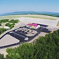 2015-built airport building
 The grave of 3 officers of the 16th Army who died in the line of duty, with a tombstone
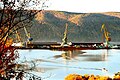 View from the square
 City square
 Post office built in 1905
 Stone Temple
 Cinema Modern, now a museum named after V.E.Rozov
 Cinema Rodina
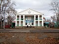 The Seamen's Club is now a grocery store.
 Nikolayevsk-on-Amur lighthouse
 Nikolaevsk-on-Amur view from the ski resort
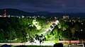 Nikolaevsk-on-Amur night view of Lunacharskogo street
 Monument of G. I. Nevelsky on the waterfront
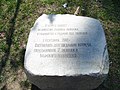 Monument of the 7th crew of the Maritime College
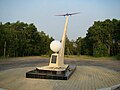 Monument to a non-stop flight


References
Wikiwand - on
Seamless Wikipedia browsing. On steroids.