Neiafu (Vavaʻu)
Place in Vavaʻu, Tonga From Wikipedia, the free encyclopedia
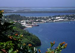
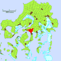
Neiafu is the second-largest town in Tonga with a population of 3,845 in 2021.[1] It is situated beside the Port of Refuge, a deep-water harbour on the south coast of Vavaʻu, the main island of the Vavaʻu archipelago in northern Tonga. To the north-west lies the 131-metre high (430 ft) Mt. Talau with its distinctive flat top.
Neiafu is the administrative centre of the Vavaʻu group and has government offices, banks, schools, a police station and a hospital. It is also an important centre for tourism with many yachts anchoring in the Port of Refuge.
In the late 19th century Neiafu was the location of a German coaling-station, established under the country's 1876 Treaty of Friendship with Tonga.[2] The base was transferred to Britain in 1900 with the establishment of a British protectorate.[3]
The town is powered by a 300kW solar PV farm with battery backup in the hamlet of Kāmeli.[4]
References
External links
Wikiwand - on
Seamless Wikipedia browsing. On steroids.


