Longci District
District From Wikipedia, the free encyclopedia
Longci
龍崎區 Tatsuzaki | |
|---|---|
| Longci District | |
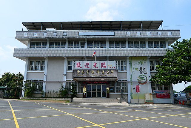
 The former Township Hall in Longci | |
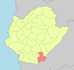
 Longci District in Tainan City | |
| Location | Tainan, Taiwan |
| Area | |
| • Total | 64 km2 (25 sq mi) |
| Population (May 2022) | |
| • Total | 3,634 |
| • Density | 57/km2 (150/sq mi) |
| Website | longci |

Longci District[1][2][3][4][5] (Chinese: 龍崎區; Hanyu Pinyin: Lóngqí Qū; Tongyong Pinyin: Lóngcí Cyu; Wade–Giles: Lung2-ch'i2 Ch'ü1; Pe̍h-ōe-jī: Liông-kiā-khu), alternatively spelled Longqi. is a rural district of about 3,634 residents in Tainan, Taiwan.
History
After the handover of Taiwan from Japan to the Republic of China in 1945, Longci was organized as a rural township of Tainan County. On 25 December 2010, Tainan County was merged with Tainan City and Longci was upgraded to a district of the city.
Geography
Longci District borders Sinhua District and Zuojhen District to the north; Neimen District, Kaohsiung to the east; Guanmiao District to the west; and Tianliao District, Kaohsiung to the south.[6]
Administrative divisions
The district consists of Qiding, Tuqi, Zhongkeng, Nankeng, Niupu, Daping, Longchuan and Shicao Village.[7]
Tourist attractions
- Cingshuei Temple
- Husing Mountain Resort Park
- Nioupu Village
- Oolong Pond[8]
References
External links
Wikiwand in your browser!
Seamless Wikipedia browsing. On steroids.
Every time you click a link to Wikipedia, Wiktionary or Wikiquote in your browser's search results, it will show the modern Wikiwand interface.
Wikiwand extension is a five stars, simple, with minimum permission required to keep your browsing private, safe and transparent.

