List of mountain passes in Kyrgyzstan
From Wikipedia, the free encyclopedia
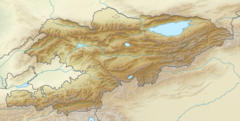
This is a list of mountain passes in Kyrgyzstan.
This section needs expansion. You can help by adding to it. (December 2014) |
| Name | Elevation | Region | Locations | Separating | Type |
|---|---|---|---|---|---|
| Dolon Pass | 3,030 metres (9,940 ft) | Naryn Region | Songköl Too and Bayduluu Range | road | |
| Torugart Pass | 3,752 metres (12,310 ft) | Naryn Region | China–Kyrgyzstan border | road | |
| Erkeshtam | 2,950 metres (9,680 ft) | Osh Region | China–Kyrgyzstan border | road | |
| Taldyk Pass | 3,615 metres (11,860 ft) | Osh Region | Alay Mountains | road | |
| Chyiyrchyk Pass | 2,389 metres (7,838 ft) | Osh Region | Osh and Gulcha | road | |
| Ak-Beyit Pass | 3,236 metres (10,617 ft) | Naryn Region | At-Bashi Valley and Arpa Valley | road | |
| Bedel Pass | 4,200 metres (13,800 ft) | Naryn Region | China–Kyrgyzstan border | path | |
| Katta Belisynyk Pass | 1,324 metres (4,344 ft) | Batken Region | Belisynyk Range | road | |
| Kyzylart Pass | 4,280 metres (14,040 ft) | Osh Region | Kyrgyzstan–Tajikistan border | road | |
| Töö Ashuu | 3,586 metres (11,765 ft) | Chüy Region | Kyrgyz Ala-Too | road | |
| Seok Pass | 4,028 metres (13,215 ft) | Naryn Region | Seok Mountains | road | |
| Tengizbay | 3,666 metres (12,028 ft) | Batken Region, Osh Region | Alay Valley and Fergana Valley | road | |
| Kyzart (pass) | 2,664 metres (8,740 ft) | Naryn Region | Kochkor Valley and Jumgal Valley | road | |
| Kara-Buura Pass | 3,305 metres (10,843 ft) | Talas Region | Talas Valley and Chatkal Valley | road | |
| Chapchyma Pass | 2,841 metres (9,321 ft) | Jalal-Abad Region | Kasan-Say Valley and Chatkal Valley | road | |
Wikiwand - on
Seamless Wikipedia browsing. On steroids.
