Dahlem, North Rhine-Westphalia
Municipality in North Rhine-Westphalia, Germany From Wikipedia, the free encyclopedia
Dahlem is a municipality in the district of Euskirchen. It has the lowest population density and population of all municipalities of in the state of North Rhine-Westphalia, Germany. It is located in the Eifel hills, approx. 35 km south-west of Euskirchen. The small medieval town Kronenburg is part of the municipality.
Dahlem | |
|---|---|
 | |
 Flag  Coat of arms | |
Location of Dahlem within Euskirchen district 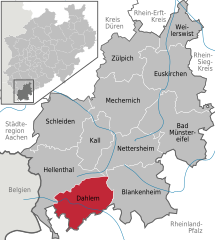 | |
 Dahlem  Dahlem | |
| Coordinates: 50°23′N 06°33′E | |
| Country | Germany |
| State | North Rhine-Westphalia |
| Admin. region | Köln |
| District | Euskirchen |
| Government | |
| • Mayor (2020–25) | Jan Lembach[1] (CDU) |
| Area | |
| • Total | 95.18 km2 (36.75 sq mi) |
| Elevation | 539 m (1,768 ft) |
| Population (2023-12-31)[2] | |
| • Total | 4,457 |
| • Density | 47/km2 (120/sq mi) |
| Time zone | UTC+01:00 (CET) |
| • Summer (DST) | UTC+02:00 (CEST) |
| Postal codes | 53949 |
| Dialling codes | 02447 |
| Vehicle registration | EU |
| Website | www.dahlem.de |
Geography
Dahlem is located in the northern Eifel region in the High Fens – Eifel Nature Park between Blankenheim in the Northeast and Stadtkyll the southwest. The Kyll flows through the region from the Glaadtbach. The Heidenköpfe lie in the Ripsdorfer forest to the east.
References
External links
Wikiwand in your browser!
Seamless Wikipedia browsing. On steroids.
Every time you click a link to Wikipedia, Wiktionary or Wikiquote in your browser's search results, it will show the modern Wikiwand interface.
Wikiwand extension is a five stars, simple, with minimum permission required to keep your browsing private, safe and transparent.