Top Qs
Timeline
Chat
Perspective
Keiskamma River
River in the Eastern Cape, South Africa From Wikipedia, the free encyclopedia
Remove ads
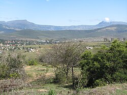
The Keiskamma River (Afrikaans: Keiskammarivier) is a river in the Eastern Cape Province in South Africa. The river flows into the Indian Ocean in the Keiskamma Estuary, located by Hamburg Nature Reserve, near Hamburg,[1] midway between East London and Port Alfred. The Keiskamma flows first in a southwestern and then in a southeastern direction after meeting its main tributary, the Tyhume River.[2]
The Keiskamma River marked the border between the Cape Province and former British Kaffraria, known also then as Queen Adelaide's Province, until 1847.[3]
Presently this river is part of the Mzimvubu to Keiskamma Water Management Area.[4]
Remove ads
Ecology
There is a small population of the endangered Eastern Province rocky (Sandelia bainsii) in the Tyhume River, part of the Keiskamma river basin.[5]
Dams
See also
References
External links
Wikiwand - on
Seamless Wikipedia browsing. On steroids.
Remove ads


