Payzawat County
County in Xinjiang, China From Wikipedia, the free encyclopedia

Payzawat County,[8][9][10][6][11] also via SASM/GNC romanization as Payziwat County[12] (Uyghur: پەيزاۋات ناھىيىسى; Chinese: 排孜阿瓦提县[4]), (also Faizabad and Fayzawat) and via Mandarin Chinese as Jiashi County (Chinese: 伽师县) is a county in Kashgar Prefecture, Xinjiang Uyghur Autonomous Region, China, on the western rim of the Taklamakan Desert. To the east, the county borders Maralbexi County, to the south Yopurga County.[4]
Payzawat County
Jiashi, Ch'ieh-shih, Faiz Abad | |
|---|---|
.png) Location of Peyziwat County (red) and Kashgar Prefecture (yellow) within Xinjiang | |
 Peyziwat Location of the seat in Xinjiang  Peyziwat Peyziwat (Xinjiang)  Peyziwat Peyziwat (China) | |
| Coordinates: 39°29′18″N 76°42′45″E | |
| Country | China |
| Autonomous region | Xinjiang |
| Prefecture | Kashgar |
| County seat | Barin[1] |
| Area | |
• Total | 6,600.68 km2 (2,548.54 sq mi) |
| Population (2020)[3] | |
• Total | 424,821 |
| • Density | 64/km2 (170/sq mi) |
| Ethnic groups | |
| • Major ethnic groups | Uyghur[4][5][6] |
| Time zone | UTC+8 (China Standard[a]) |
| Postal code | 844300 |
| Website | www |
| Payzawat County | |||||||||||
|---|---|---|---|---|---|---|---|---|---|---|---|
| Uyghur name | |||||||||||
| Uyghur | پەيزاۋات ناھىيىسى | ||||||||||
| |||||||||||
| Chinese name | |||||||||||
| Simplified Chinese | 伽师县 | ||||||||||
| Traditional Chinese | 伽師縣 | ||||||||||
| |||||||||||
| Alternative Chinese name | |||||||||||
| Simplified Chinese | 排孜阿瓦提县 | ||||||||||
| Traditional Chinese | 排孜阿瓦提縣 | ||||||||||
| |||||||||||
| Kazakh name | |||||||||||
| Kazakh | ءپايزاۋات اۋدانى Пәйзауат ауданы Päizauat audany | ||||||||||
Name
This article needs additional citations for verification. (March 2020) |
The name "Jiashi" was first used in Chinese documents of Tang Dynasty and was adopted when Emperor Guangxu established the county in 1902. Allegedly the word is a transliteration of a celestial Turkic word for jade and has the same origin to "Kashi", Mandarin transliteration for "Kashgar". The Uyghur name "Payziwat" means "God's blessing of fortune" and was sometimes used in documents in Qing Dynasty.[citation needed] Payzawat means 'beautiful land of plenty'.[4]
The name of the region is also transliterated as Faizabad.[11][13][14]
History
Summarize
Perspective
Peyziwat County was established in July 1902.[2][15]
In 1981, there was a brief pro-independence rebellion, the Jiashi uprising (1981年伽师县"5·27"暴乱), in the county staged by Uyghur activists after riots in Kashgar.[16][17][18]
The 1997 Jiashi earthquakes, continuing to 2003, were a series of deadly earthquakes in the county.[6] Rebiya Kadeer wrote that her career was significantly affected by the earthquakes, which were "one of the worst natural disasters that had occurred in the Uyghur nation in recent memory." One hundred villages and one thousand homes were leveled. Kadeer organized donations and aid for the area.[19] In February 2002, a 6.7 magnitude earthquake killed 267 people in Maralbexi County and Payzawat County.[20]
On August 27, 2008, two ethnic Uyghur police officers were killed.[21][22]
On October 20, 2014, Shaptul (Xiaputule) was changed from a township to a town.[1][23]
In 2017, Jiashi County Secondary Vocational School (伽师县中等职业学校), one of the Xinjiang internment camps, was increased in size, adding new dormitories and factory warehouses; significant security features were added through the introduction of secure 'military-style management'.[24]
On the night of January 19, 2020, a strong earthquake (2020年喀什地震) damaged buildings and seriously injured at least one person in the county.[7][25][26]
Administrative divisions
Summarize
Perspective
Payzawat County includes 6 towns, 7 townships, and one other area:[1][27][28]
| Name | Simplified Chinese | Hanyu Pinyin | Uyghur (UEY) | Uyghur Latin (ULY) | Administrative division code | Notes | |
|---|---|---|---|---|---|---|---|
| Towns | |||||||
| Barin Town | 巴仁镇 | Bārén Zhèn | بارىن بازىرى[29] | barin baziri | 653129100 | ||
| Shekerkol Town | 西克尔库勒镇 | Xīkè'ěrkùlè Zhèn | شېكەركۆل بازىرى | shëkerköl baziri | 653129101 | ||
| Shaptul Town[30] | 夏普吐勒镇 | Xīkè'ěrkùlè Zhèn | شاپتۇل بازىرى | shaptul baziri | 653129102 | formerly Shaptul Township (شاپتۇل يېزىسى / 夏普吐勒乡) | |
| Gholtoghraq Town | 卧里托格拉克镇 | Wòlǐtuōgélākè Zhèn | غولتوغراق بازىرى | gholtoghraq baziri | 653129103 | formerly Gholtoghraq Township (卧里托格拉克乡) | |
| Qizilboyi Town | 克孜勒博依镇 | Kèzīlèbóyī Zhèn | قىزىلبويى بازىرى | qizilboyi baziri | 653129104 | formerly Qizilboyi Township (قىزىلبويى يېزىسى / 克孜勒博依乡) | |
| Qoshawat Town | 和夏阿瓦提镇 | Kèzīlèbóyī Zhèn | قوشئاۋات بازىرى | qosh'awat baziri | 653129107 | formerly Qoshawat Township ( قوشئاۋات يېزىسى / 和夏阿瓦提乡) | |
| Townships | |||||||
| Terim Township | 铁日木乡 | Tiěrìmù Xiāng | تېرىم يېزىسى | tërim yëzisi | 653129200 | ||
| Yengimehelle Township | 英买里乡 | Yīngmǎilǐ Xiāng | يېڭىمەھەللە يېزىسى | yëngimehelle yëzisi | 653129201 | ||
| Janbaz Township | 江巴孜乡 | Jiāngbāzī Xiāng | جانباز يېزىسى | janbaz yëzisi | 653129202 | ||
| Misha Township | 米夏乡 | Mǐxià Xiāng | مىشا يېزىسى | misha yëzisi | 653129205 | ||
| Kizilsu Township[31] | 克孜勒苏乡 | Kèzīlèsū Xiāng | قىزىلسۇ يېزىسى | qizilsu yëzisi | 653129208 | ||
| Gulluk Township | 古勒鲁克乡 | Gǔlèlǔkè Xiāng | گۈللۈك يېزىسى | güllük yëzisi | 653129209 | ||
| Ordeklik Township | 玉代克力克乡 | Yùdàikèlìkè Xiāng | ئۆردەكلىك يېزىسى | Ördeklik yëzisi | 653129210 | ||
Economy
The system of irrigation is well-developed. Agricultural products include wheat, corn, sorghum, cotton and muskmelon. Animal herding is also common, primarily sheep. Specialities of the county include the 'Payzawat melon' (伽师瓜) and white grapes without pits. Industries include tractors, electronics, leather making, construction, and cotton and melon processing.[2]
As of 1885[update], there was about 55,400 acres (366,889 mu) of cultivated land in Payzawat.[32]
Demographics
| Year | Pop. | ±% p.a. |
|---|---|---|
| 2000 | 311,733 | — |
| 2010 | 381,767 | +2.05% |
| [1] | ||
As of 2015, 437,073 of the 445,846 residents of the county were Uyghur, 8,342 were Han Chinese, 431 were from other ethnic groups.[33]
As of 2009[update], Uyghurs made up 98.9% of the county's population.[4]
According to the 2002 census, it has a population of 320,000.[citation needed]
As of 1999, 96.46% of the population of Payzawat (Jiashi) County was Uyghur and 3.52% of the population was Han Chinese.[34]
In 1997, Uyghurs made up 97.2% of the county's population.[5]
Climate
| Climate data for Payzawat, elevation 1,205 m (3,953 ft), (1991–2020 normals, extremes 1981–2010) | |||||||||||||
|---|---|---|---|---|---|---|---|---|---|---|---|---|---|
| Month | Jan | Feb | Mar | Apr | May | Jun | Jul | Aug | Sep | Oct | Nov | Dec | Year |
| Record high °C (°F) | 19.0 (66.2) |
19.7 (67.5) |
30.2 (86.4) |
35.3 (95.5) |
36.4 (97.5) |
39.6 (103.3) |
39.8 (103.6) |
40.1 (104.2) |
35.4 (95.7) |
30.8 (87.4) |
25.8 (78.4) |
19.9 (67.8) |
40.1 (104.2) |
| Mean daily maximum °C (°F) | 0.7 (33.3) |
6.9 (44.4) |
16.2 (61.2) |
24.3 (75.7) |
28.6 (83.5) |
32.1 (89.8) |
33.7 (92.7) |
32.3 (90.1) |
28.1 (82.6) |
21.4 (70.5) |
12.0 (53.6) |
2.7 (36.9) |
19.9 (67.9) |
| Daily mean °C (°F) | −5.7 (21.7) |
0.2 (32.4) |
9.1 (48.4) |
16.6 (61.9) |
20.7 (69.3) |
24.1 (75.4) |
25.7 (78.3) |
24.2 (75.6) |
19.7 (67.5) |
12.3 (54.1) |
3.8 (38.8) |
−3.6 (25.5) |
12.3 (54.1) |
| Mean daily minimum °C (°F) | −10.9 (12.4) |
−5.7 (21.7) |
2.5 (36.5) |
9.2 (48.6) |
13.4 (56.1) |
16.7 (62.1) |
18.6 (65.5) |
17.3 (63.1) |
12.6 (54.7) |
5.1 (41.2) |
−2.3 (27.9) |
−8.1 (17.4) |
5.7 (42.3) |
| Record low °C (°F) | −24.8 (−12.6) |
−25.5 (−13.9) |
−7.7 (18.1) |
−1.4 (29.5) |
4.3 (39.7) |
6.6 (43.9) |
10.7 (51.3) |
9.8 (49.6) |
4.1 (39.4) |
−3.9 (25.0) |
−13.0 (8.6) |
−21.6 (−6.9) |
−25.5 (−13.9) |
| Average precipitation mm (inches) | 2.6 (0.10) |
3.8 (0.15) |
5.1 (0.20) |
4.0 (0.16) |
12.5 (0.49) |
11.5 (0.45) |
11.1 (0.44) |
15.0 (0.59) |
9.1 (0.36) |
3.1 (0.12) |
1.9 (0.07) |
2.0 (0.08) |
81.7 (3.21) |
| Average precipitation days (≥ 0.1 mm) | 2.6 | 1.8 | 1.5 | 1.6 | 3.7 | 4.6 | 4.6 | 5.1 | 2.9 | 1.1 | 0.7 | 2.0 | 32.2 |
| Average snowy days | 5.9 | 2.9 | 0.7 | 0 | 0 | 0 | 0 | 0 | 0 | 0 | 0.6 | 4.7 | 14.8 |
| Average relative humidity (%) | 66 | 56 | 44 | 37 | 41 | 43 | 47 | 54 | 57 | 59 | 61 | 70 | 53 |
| Mean monthly sunshine hours | 155.7 | 170.3 | 202.7 | 230.0 | 279.9 | 310.5 | 321.3 | 293.6 | 267.6 | 253.3 | 201.3 | 155.1 | 2,841.3 |
| Percentage possible sunshine | 51 | 55 | 54 | 57 | 62 | 70 | 72 | 70 | 73 | 75 | 68 | 53 | 63 |
| Source: China Meteorological Administration[35][36] | |||||||||||||
Transportation
Historical maps
Historical English-language maps including Payzawat:
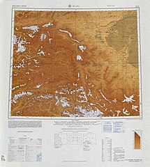 Map including Payzawat (labeled as CH'IEH-SHIH (FAIZ ABAD)) from the International Map of the World (AMS, 1966)[b]
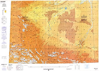
 Map including Payzawat (labeled as CH'IEH-SHIH) (DMA, 1974)


Notes
- Locals in Xinjiang frequently observe UTC+6 (Xinjiang Time), 2 hours behind Beijing.
References
External links
Wikiwand - on
Seamless Wikipedia browsing. On steroids.