Top Qs
Timeline
Chat
Perspective
Jabaquara (district of São Paulo)
District of São Paulo, Brazil From Wikipedia, the free encyclopedia
Remove ads
Remove ads
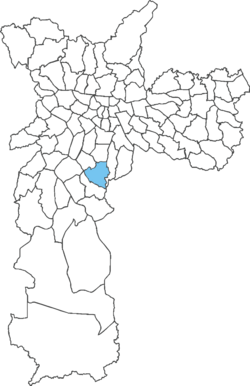
Jabaquara is one of 96 districts in the city of São Paulo, Brazil.[1] The name Jabaquara comes from tupi, îababa (escape) and kûara (den). Most probably due to several quilombos that existed in the area.[2]
Avenida Engenheiro Armando de Arruda Pereira is the main road that runs through the district. This road is part of the São Mateus–Jabaquara Metropolitan Corridor, which connects with the ABC Paulista region. The district is also home to a section of the Rodovia dos Imigrantes located in the capital of São Paulo.[3]
Remove ads
See also
References
Wikiwand - on
Seamless Wikipedia browsing. On steroids.
Remove ads

