Inishkeel
Irish monastery From Wikipedia, the free encyclopedia
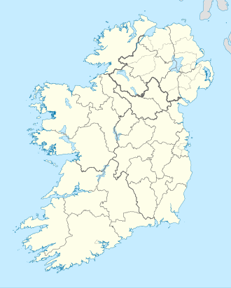
Inishkeel (Irish: Inis Caoil)[3] is a small tidal island and townland[1] off the coast of County Donegal, Ireland. The closest village on the mainland is Narin. The island is in a civil parish of the same name.[4]
Native name: Inis Caoil | |
|---|---|
 Building at the south east end of Inishkeel | |
| Geography | |
| Location | Atlantic Ocean |
| Coordinates | 54°50′51″N 8°27′22″W |
| Area | 0.391 km2 (0.151 sq mi)[1] |
| Administration | |
| Province | Ulster |
| County | Donegal |
| Demographics | |
| Population | 0 (2011[2]) |
Geography
The island is located in Gweebarra Bay around 250 m from the coast. A sandy tidal bank connects, with low tide, the island with the mainland.[3]
History

During the 6th century A.D. a small community of monks settled on the island.[5] Their religious leader was Saint Conall Cael, from whom the island later derived its name. During the following centuries Inishkeel was a traditional destination of pilgrimages. Remains of the church and the connected buildings as well as some carved stones can be seen on the island.[6] For its artistical and archeological importance the island was declared National Monument (code: DG064-003).[7] A bell known as St Conall Cael's Bell remained on Inishkeel up to the 19th century and was then acquired by the British Museum.[8]
Demography
A small community used to live on Inishkeel in the past, and in year 1841 23 inhabitants were registered on the island.[9] The island was later abandoned and in 2011 census had no inhabitants.[2]
References
See also
Wikiwand - on
Seamless Wikipedia browsing. On steroids.

