Loading AI tools
This list is of the Historic Sites of Japan located within the Prefecture of Aomori.[1]
National Historic Sites
Summarize
Perspective
As of 17 December 2021, twenty-three Sites have been designated as being of national significance (including one *Special Historic Site).[2][3][4]
| Site | Municipality | Comments | Image | Coordinates | Type | Ref. |
|---|---|---|---|---|---|---|
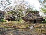
| *Sannai-Maruyama Site 三内丸山遺跡 Sannai-Maruyama iseki |
Aomori | inscribed on the UNESCO World Heritage List as one of the Jōmon Prehistoric Sites in Northern Japan[5] |  |
40°48′40″N 140°41′55″E | 1 | 108 |
| Akōbō Kofun Cluster 阿光坊古墳群 Akōbō kofun-gun |
Oirase | Kofun period tumuli |  |
40°36′34″N 141°22′36″E | 1 | 00003536 |
| Kamegaoka Stone Age Site 亀ヶ岡石器時代遺跡 Kamegaoka sekki-jidai iseki |
Tsugaru | inscribed on the UNESCO World Heritage List as one of the Jōmon Prehistoric Sites in Northern Japan[5] |  |
40°53′06″N 140°20′22″E | 1 | 97 |
| Goshogawara Sue Pottery Kiln Site 五所川原須恵器窯跡 Goshogawara Sue-ki kama ato |
Goshogawara | Heian period kiln ruins | 40°45′31″N 140°32′49″E | 6 | 3397 | |
| Takayashikidate Site 高屋敷館遺跡 Takayashikidate iseki |
Aomori | Heian period settlement ruins |  |
40°44′13″N 140°35′04″E | 1 | 3276 |
| Ne Castle ruins 根城跡 Ne-jō ato |
Hachinohe | Muromachi period |  |
40°30′22″N 141°27′39″E | 2 | 95 |
| Shichinohe Castle ruins 七戸城跡 Shichinohe-jō ato |
Shichinohe | Muromachi period castle ruins |  |
40°41′52″N 141°08′57″E | 2 | 96 |
| Tosaminato ruins 十三湊遺跡 Tosa minato iseki |
Goshogawara | Muromachi period settlement ruins | 41°01′43″N 140°19′46″E | 1, 2, 6 | 00003446 | |
| Komakino Site 小牧野遺跡 Komakino iseki |
Aomori | inscribed on the UNESCO World Heritage List as one of the Jōmon Prehistoric Sites in Northern Japan[5] |  |
40°44′19″N 141°08′57″E | 1 | 107 |
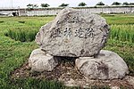
| Tareyanagi Site 垂柳遺跡 Tareyanagi iseki |
Inakadate | Yayoi period rice paddies[6] |  |
40°37′59″N 140°33′57″E | 6 | 3251 |
| Korekawa Site 是川遺跡 Korekawa iseki |
Hachinohe | ICP excavated artefacts;[7] inscribed on the UNESCO World Heritage List as one of the Jōmon Prehistoric Sites in Northern Japan[5] |  |
40°28′25″N 141°29′28″E | 1 | 101 |
| Shōjujidate Castle ruins 聖寿寺館跡 Shōjujitate ato |
Nanbu | Muromachi period castle ruins |  |
40°24′45″N 141°15′54″E | 2 | 3396 |
| Tangotai Kofun cluster 丹後平古墳群 Tangotai kofun |
Hachinohe | Kofun period tumuli | 40°28′52″N 141°28′01″E | 1 | 3207 | |
| Chōshichiyachi Shell Mound 長七谷地貝塚 Chōshichiyachi kaizuka |
Hachinohe |  |
40°34′19″N 141°27′32″E | 1 | 106 | |
| Tsugaru Clan Castle Sites 津軽氏城跡 Tsugaru-shi shiro ato |
Hirosaki, Ajigasawa | designation includes the sites of Tanesato Castle, Horikoshi Castle, and Hirosaki Castle (pictured) |  |
40°36′27″N 140°27′51″E | 2 | 99 |
| Tagoyano Shell Mound 田小屋野貝塚 Tagoyano kaizuka |
Tsugaru | site inscribed on the UNESCO World Heritage List as one of the Jōmon Prehistoric Sites in Northern Japan[5] |  |
40°53′17″N 140°20′21″E | 1 | 98 |
| Futatsumori Site 二ツ森貝塚 Futatsumori kaizuka |
Shichinohe | inscribed on the UNESCO World Heritage List as one of the Jōmon Prehistoric Sites in Northern Japan[5] |  |
40°44′54″N 141°13′47″E | 1 | 3206 |
| Hamashiriya Shell Mound 浜尻屋貝塚 Hamashiriya kaizuka |
Higashidōri | Muromachi period shell middens | 41°24′38″N 141°27′31″E | 1 | 00003495 | |
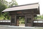
| Namioka Castle ruins 浪岡城跡 Namioka-jō ato |
Aomori | Muromachi period castle ruins |  |
40°43′04″N 140°36′17″E | 2 | 93 |
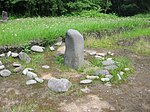
| Ōmori Katsuyama Site 大森勝山遺跡 Ōmori Katsuyama iseki |
Hirosaki | Jōmon period stone circle; inscribed on the UNESCO World Heritage List as one of the Jōmon Prehistoric Sites in Northern Japan[5] |  |
40°36′11″N 140°27′50″E | 1 | 00003759 |
| Ōdai Yamamoto I Site 大平山元遺跡 Ōdai Yamamoto iseki |
Sotogahama | inscribed on the UNESCO World Heritage List as one of the Jōmon Prehistoric Sites in Northern Japan[5] |  |
41°04′02″N 140°33′18″E | 1 | 00003780 |
| Sannobō Site 山王坊遺跡 Sannobō iseki |
Goshogawara | Muromachi period temple ruins |  |
41°03′58″N 140°22′02″E | 3 | 00003964 |
| Sannohe Castle Site 三戸城跡 Sannohe-jō ato | Sannohe |  | 40°22′52″N 141°15′50″E | 2 |
Prefectural Historic Sites
Summarize
Perspective
As of 11 October 2021, a further twenty Sites have been designated as being of prefectural importance.[4][8]
| Site | Municipality | Comments | Image | Coordinates | Type | Ref. |
|---|---|---|---|---|---|---|
| Seki Old Stelai 関の古碑群 Seki no ko-hi-gun | Fukaura | forty-two C14 memorial stelai | 40°44′23″N 140°06′14″E | |||
| Hachinohe Nanbu clan cemetery 八戸南部家墓所 Hachinohe nanbu-ke bosho | Hachinohe |  | 40°30′10″N 141°29′20″E | |||
| Karauma Stele 唐馬の碑 Karauma no hi | Sannohe | 40°23′45″N 141°15′50″E | ||||
| Tenma Ichirizuka 一里塚 ichirizuka | Hachinohe | in Tenma; one mound survives | 40°28′33″N 141°30′47″E | |||
| Tairakubo Ichirizuka 一里塚 ichirizuka | Towada | in Tairakubo; both mounds survive | 40°34′29″N 141°15′53″E | |||
| Ikenotani Ichirizuka 一里塚 ichirizuka | Towada | in Ikenotai; both mounds survive | 40°40′34″N 141°10′29″E | |||
| Bonozuka Ichirizuka 一里塚 ichirizuka | Noheji | in Bonozuka; both mounds survive | 40°51′33″N 141°07′36″E | |||
| Sotsukozawa Ichirizuka 一里塚 ichirizuka | Shichinohe | in Sotsukozawa; both mounds survive | 40°47′00″N 141°10′21″E | |||
| Morinokami Ichirizuka 一里塚 ichirizuka | Shichinohe | in Morinokami; both mounds survive | 40°44′45″N 141°09′24″E | |||
| Nagakubo Ichirizuka 一里塚 ichirizuka | Hachinohe | in Nagakubo; one mound survives | 40°26′14″N 141°27′48″E | |||
| Shinden Ichirizuka 一里塚 ichirizuka | Hachinohe | in Shinden; both mounds survive | 40°24′34″N 141°26′21″E | |||
| Sunakozaki Ichirizuka 一里塚 ichirizuka | Hachinohe | in Sunakozaki; both mounds survive | 40°22′36″N 141°25′01″E | |||
| Yahatazaki Site 八幡崎遺跡 Yahatazaki iseki | Hirakawa | 40°37′03″N 140°32′07″E | ||||
| Hankyōzuka 藩境塚 Hankyōzuka | Hiranai/Noheji | four mounds | 40°53′14″N 141°04′57″E | |||
| Battle of Noheji cemetery 野辺地戦争戦死者の墓所 Noheji-sensō senshisha no bosho | Noheji |  | 40°52′16″N 141°06′34″E | |||
| Nakano Ichirizuka 一里塚 ichirizuka | Sannohe | in Nakano; both mounds survive | 40°21′01″N 141°15′43″E | |||
| Tonai Mass Graves and Memorial Stele 斗内千人塚 墳丘 供養塔 Tonai senninzuka funkyū kuyōtō | Sannohe | from the great famine of 1783-4 (天明の大飢饉) | 40°21′34″N 141°12′25″E | |||
| Memorial Stele and Platform for the Starved 餓死萬霊等供養塔及び戒壇石 Gashi banrei-tō kuyōtō oyobi kaidanseki | Hachinohe | from the 1780s famine; in Teranoue | 40°29′55″N 141°31′35″E | |||
| Nakasato Castle ruins 中里城遺跡 Nakasato-jō iseki | Nakadomari | 40°58′13″N 140°26′30″E | ||||
| Tairadate Battery ruins 平舘台場跡 Tairadate daiba ato | Sotogahama | 41°10′28″N 140°38′34″E | ||||
Municipal Historic Sites
As of 1 May 2021, a further ninety-two Sites have been designated as being of municipal importance.[9]
See also
Wikimedia Commons has media related to National historic sites in Aomori prefecture.
Wikimedia Commons has media related to Prefectural Historic Sites in Aomori Prefecture.
References
External links
Wikiwand in your browser!
Seamless Wikipedia browsing. On steroids.
Every time you click a link to Wikipedia, Wiktionary or Wikiquote in your browser's search results, it will show the modern Wikiwand interface.
Wikiwand extension is a five stars, simple, with minimum permission required to keep your browsing private, safe and transparent.