Hay River/Merlyn Carter Airport
Public airport in Northwest Territories, Canada From Wikipedia, the free encyclopedia
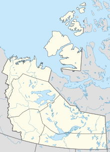
Hay River/Merlyn Carter Airport (IATA: YHY, ICAO: CYHY) is located 1.5 nautical miles (2.8 km; 1.7 mi) north of Hay River, Northwest Territories, Canada.
Hay River/Merlyn Carter Airport | |||||||||||||||
|---|---|---|---|---|---|---|---|---|---|---|---|---|---|---|---|
 Hay River Airport sign | |||||||||||||||
 Airport terminal | |||||||||||||||
| Summary | |||||||||||||||
| Airport type | Public | ||||||||||||||
| Operator | Government of the Northwest Territories | ||||||||||||||
| Location | Hay River, Northwest Territories | ||||||||||||||
| Time zone | MST (UTC−07:00) | ||||||||||||||
| • Summer (DST) | MDT (UTC−06:00) | ||||||||||||||
| Elevation AMSL | 541 ft / 165 m | ||||||||||||||
| Coordinates | 60°50′23″N 115°46′58″W | ||||||||||||||
| Map | |||||||||||||||
 | |||||||||||||||
| Runways | |||||||||||||||
| |||||||||||||||
| Statistics (2010) | |||||||||||||||
| |||||||||||||||
The airport is named for former bush pilot Merlyn Carter, who was killed by a black bear in 2005.[4]
Sandhill cranes may be found nesting on the airport from May until September.
Airlines and destinations
| Airlines | Destinations |
|---|---|
| Air Tindi | Yellowknife[5] |
| Canadian North | Yellowknife[6] |
| Northwestern Air | Edmonton, Fort Smith, High Level (all end 16 January 2025)[7] |
Cargo
| Airlines | Destinations |
|---|---|
| Buffalo Airways | Yellowknife |
See also
References
External links
Wikiwand in your browser!
Seamless Wikipedia browsing. On steroids.
Every time you click a link to Wikipedia, Wiktionary or Wikiquote in your browser's search results, it will show the modern Wikiwand interface.
Wikiwand extension is a five stars, simple, with minimum permission required to keep your browsing private, safe and transparent.


