Guelmim
Place in Guelmim-Oued Noun, Morocco From Wikipedia, the free encyclopedia
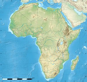
Guelmim[a] is a city in southern Morocco, often called Gateway to the Desert. It is the capital of the Guelmim-Oued Noun region which includes southern Morocco (south of the Souss-Massa region) and the northeastern corner of Western Sahara. The population of the city was 187,808 as of the 2014 Moroccan census,[1] making it the largest city in the region. The N1 and N12 highways cross at Guelmim and link it to the nearby region of Souss-Massa.
Guelmim
| |
|---|---|
| Coordinates: 28°59′N 10°04′W | |
| Country | Morocco |
| Region | Guelmim-Oued Noun |
| Province | Guelmim |
| Population (2014)[1] | |
• Total | 118,318 |
| Time zone | UTC+1 (CET) |
Guelmim is located just north of Asrir, which was the site of an important trade-route city and the capital of the Saharan Berber tribes. It is home to a camel market. Most of the inhabitants speak either the Tachelhit language or the Hassaniya dialect of Sahrawi Arabs, as it is part of the Sahrawi-inhabited southern region of Morocco.
Climate
Summarize
Perspective
Guelmim has a hot desert climate (Köppen climate classification BWh).
| Climate data for Guelmim (1991–2020) | |||||||||||||
|---|---|---|---|---|---|---|---|---|---|---|---|---|---|
| Month | Jan | Feb | Mar | Apr | May | Jun | Jul | Aug | Sep | Oct | Nov | Dec | Year |
| Record high °C (°F) | 30.4 (86.7) |
32.2 (90.0) |
37.2 (99.0) |
38.8 (101.8) |
44.2 (111.6) |
46.3 (115.3) |
47.6 (117.7) |
47.0 (116.6) |
44.5 (112.1) |
42.6 (108.7) |
35.3 (95.5) |
30.0 (86.0) |
47.6 (117.7) |
| Mean daily maximum °C (°F) | 20.9 (69.6) |
22.4 (72.3) |
24.9 (76.8) |
25.4 (77.7) |
27.0 (80.6) |
29.2 (84.6) |
32.9 (91.2) |
34.1 (93.4) |
31.3 (88.3) |
29.1 (84.4) |
24.9 (76.8) |
21.8 (71.2) |
27.0 (80.6) |
| Daily mean °C (°F) | 14.7 (58.5) |
16.1 (61.0) |
18.4 (65.1) |
19.2 (66.6) |
20.9 (69.6) |
22.9 (73.2) |
25.5 (77.9) |
26.5 (79.7) |
24.3 (75.7) |
22.5 (72.5) |
18.7 (65.7) |
16.0 (60.8) |
20.5 (68.9) |
| Mean daily minimum °C (°F) | 8.5 (47.3) |
9.8 (49.6) |
11.7 (53.1) |
13.0 (55.4) |
14.7 (58.5) |
16.5 (61.7) |
18.1 (64.6) |
18.9 (66.0) |
17.4 (63.3) |
15.9 (60.6) |
12.4 (54.3) |
10.0 (50.0) |
13.9 (57.0) |
| Record low °C (°F) | 0.7 (33.3) |
1.3 (34.3) |
4.0 (39.2) |
6.0 (42.8) |
7.4 (45.3) |
10.2 (50.4) |
13.4 (56.1) |
13.2 (55.8) |
9.2 (48.6) |
7.2 (45.0) |
3.0 (37.4) |
1.6 (34.9) |
0.7 (33.3) |
| Average precipitation mm (inches) | 13.4 (0.53) |
16.6 (0.65) |
16.8 (0.66) |
5.5 (0.22) |
2.8 (0.11) |
0.6 (0.02) |
0.1 (0.00) |
2.9 (0.11) |
5.2 (0.20) |
11.6 (0.46) |
22.2 (0.87) |
21.2 (0.83) |
118.9 (4.68) |
| Average precipitation days (≥ 1.0 mm) | 2.5 | 2.8 | 2.6 | 1.2 | 0.4 | 0.2 | 0.0 | 0.6 | 0.5 | 1.6 | 2.5 | 3.1 | 18.0 |
| Source: NOAA[2] | |||||||||||||
See also
Notes
- Arabic: كلميم, romanized: kulmīm, Moroccan Arabic: ڭلميم, romanized: gulmīm, Hassaniyya: گليميم, romanized: gleymīm, Tachelhit: ⴳⵯⴻⵍⵎⵉⵎ, romanized: gʷelmim; also spelled in European sources: Glaimim, Goulimine or Guelmin
References
External links
Wikiwand - on
Seamless Wikipedia browsing. On steroids.


