Local government areas of Tasmania
From Wikipedia, the free encyclopedia
Councils of Tasmania are the 29 administrative districts of the Australian state of Tasmania. Local government areas (LGAs), more generally known as councils, are the tier of government responsible for the management of local duties such as road maintenance, town planning and waste management.
Local government areas
Summarize
Perspective
There are 29 local government areas of Tasmania:
| Local government area | Principal town | Date established | Land area[1] | Demographics | Map | |||
|---|---|---|---|---|---|---|---|---|
| km2 | sq mi | Population[1] (2022) |
Density[1] (per km2) |
Classification | ||||
| Break O'Day | St Helens | 1993 | 3,523.9 | 1,361 | 7,013 | 2.0 | Rural |  |
| Brighton | Brighton | 1863 | 171.2 | 66 | 19,687 | 115.0 | Urban | 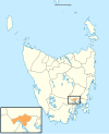 |
| Burnie | Burnie | 1908 | 611.0 | 236 | 20,497 | 33.5 | Urban | 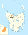 |
| Central Coast | Ulverstone | 1993 | 933.1 | 360 | 23,360 | 25.0 | Urban |  |
| Central Highlands | Hamilton | 1993 | 7,982.4 | 3,082 | 2,585 | 0.3 | Rural |  |
| Circular Head | Smithton | 1907 | 4,898.0 | 1,891 | 8,383 | 1.7 | Rural |  |
| Clarence | Rosny Park | 1860 | 378.0 | 146 | 63,138 | 167.0 | Urban |  |
| Derwent Valley | New Norfolk | 1994 | 4,108.1 | 1,586 | 11,251 | 2.7 | Rural | 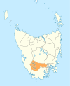 |
| Devonport | Devonport | 1907 | 111.3 | 43 | 26,970 | 242.4 | Urban |  |
| Dorset | Scottsdale | 1993 | 3,230.5 | 1,247 | 7,022 | 2.2 | Rural |  |
| Flinders | Whitemark | 1907 | 1,996.6 | 771 | 931 | 0.5 | Rural | 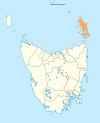 |
| George Town | George Town | 1907 | 653.4 | 252 | 7,281 | 11.1 | Rural |  |
| Glamorgan–Spring Bay | Triabunna | 1993 | 2,591.6 | 1,001 | 5,194 | 2.0 | Rural | 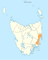 |
| Glenorchy | Glenorchy | 1864 | 121.1 | 47 | 51,083 | 421.6 | Urban | 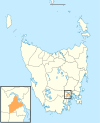 |
| Hobart | Hobart | 1852 | 77.9 | 30 | 56,043 | 719.5 | Urban | 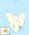 |
| Huon Valley | Huonville | 1993 | 5,507.4 | 2,126 | 19,221 | 3.5 | Rural |  |
| Kentish | Sheffield | 1907 | 1,156.2 | 446 | 6,807 | 5.9 | Rural |  |
| King Island | Currie | 1907 | 1,095.7 | 423 | 1,677 | 1.5 | Rural | 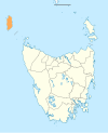 |
| Kingborough | Kingston | 1907 | 720.1 | 278 | 40,979 | 56.9 | Urban | 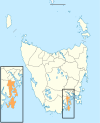 |
| Latrobe | Latrobe | 1907 | 600.5 | 232 | 12,926 | 21.5 | Rural |  |
| Launceston | Launceston | 1852 | 1,413.6 | 546 | 71,980 | 50.9 | Urban |  |
| Meander Valley | Westbury | 1993 | 3,330.8 | 1,286 | 21,369 | 6.4 | Rural | 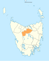 |
| Northern Midlands | Longford | 1993 | 5,135.3 | 1,983 | 14,143 | 2.8 | Rural | 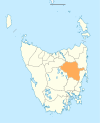 |
| Sorell | Sorell | 1862 | 583.8 | 225 | 17,430 | 29.9 | Semi-rural |  |
| Southern Midlands | Oatlands | 1993 | 2,615.5 | 1,010 | 6,891 | 2.6 | Rural | 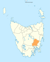 |
| Tasman | Nubeena | 1907 | 660.4 | 255 | 2,671 | 4.0 | Rural | 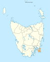 |
| Waratah–Wynyard | Wynyard | 1993 | 3,535.9 | 1,365 | 14,695 | 4.0 | Rural | 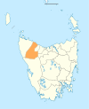 |
| West Coast | Queenstown | 1993 | 9,583.5 | 3,700 | 4,358 | 0.5 | Rural |  |
| West Tamar | Beaconsfield | 1993 | 691.1 | 267 | 25,955 | 37.6 | Urban |  |
Towns and suburbs of local government areas
Summarize
Perspective

The local government areas include the following towns and suburbs, with some towns and suburbs some spanning multiple local government areas:
Break O'Day Council
Brighton Council
Central Coast Council
Central Highlands Council
Circular Head Council
City of Burnie
- Acton
- Chasm Creek
- Cooee
- Downlands
- East Ridgley
- Emu Heights
- Highclere
- Mooreville
- Ridgley
- West Mooreville
- West Ridgley
- Brooklyn
- Camdale
- East Cam
- Glance Creek
- Hampshire
- Havenview
- Hillcrest
- Montello
- Natone
- Ocean Vista
- Park Grove
- Parklands
- Romaine
- Round Hill
- Shorewell Park
- South Burnie
- Stowport
- Tewkesbury
- Upper Burnie
- Upper Natone
- Upper Stowport
- Wivenhoe
City of Clarence
City of Devonport
City of Glenorchy
City of Hobart
City of Launceston
Derwent Valley Council
- Adamsfield
- Black Hills
- Boyer
- Bushy Park
- Feilton
- Fenton Forest
- Fitzgerald
- Glenfern
- Glenora
- Granton
- Hayes
- Karanja
- Lachlan
- Lawitta
- Macquarie Plains
- Magra
- Malbina
- Maydena
- Molesworth
- Moogara
- Mount Field
- Mount Lloyd
- National Park
- New Norfolk
- Plenty
- Rosegarland
- Sorell Creek
- Strathgordon
- Tyenna
- Upper Plenty
- Uxbridge
- Westerway
Dorset Council
Flinders Council
George Town Council
Glamorgan Spring Bay Council
Huon Valley Council
- Barretts Bay
- Brooks Bay
- Cairns Bay
- Castle Forbes Bay
- Charlotte Cove
- Crabtree
- Cradoc
- Cygnet
- Deep Bay
- Dover
- Eggs and Bacon Bay
- Franklin
- Garden Island Creek
- Garden Island Sands
- Gardners Bay
- Geeveston
- Glaziers Bay
- Glen Huon
- Glendevie
- Golden Valley
- Grove
- Hastings
- Huonville
- Ida Bay
- Judbury
- Lonnavale
- Lower Longley
- Lower Wattle Grove
- Lucaston
- Lune River
- Lymington
- Mountain River
- Nicholls Rivulet
- Pelverata
- Petcheys Bay
- Police Point
- Port Huon
- Raminea
- Randalls Bay
- Ranelagh
- Recherche
- Strathblane
- Surges Bay
- Surveyors Bay
- Upper Woodstock
- Verona Sands
- Wattle Grove
- Woodstock
- Cygnet
- Eggs and Bacon Bay
- Dover
- Franklin
- Geeveston
- Port Huon
- Glen Huon
- Huonville
- Southport
Kentish Council
- Acacia Hills
- Cradle Mountain
- Liena
- Mersey Forest
- Railton
- Sheffield
- Weegena
King Island Council
Kingborough Council
- Adventure Bay
- Alonnah
- Apollo Bay
- Barnes Bay
- Dennes Point
- Great Bay
- Killora
- Lunawanna
- North Bruny
- Simpsons Bay
- South Bruny
- Blackmans Bay
- Bonnet Hill
- Howden
- Huntingfield
- Kingston
- Kingston Beach
- Taroona
- Albion Heights
- Allens Rivulet
- Coningham
- Cradoc
- Electrona
- Gordon
- Kaoota
- Kettering
- Longley
- Lucaston
- Lower Longley
- Margate
- Neika
- Oyster Cove
- Pelverata
- Sandfly
- Snug
- The Lea
- Tinderbox
- Woodstock
Latrobe Council
Meander Valley Council
Municipality of Tasman
Northern Midlands Council
Sorell Council
Southern Midlands Council
Waratah-Wynyard Council
West Coast Council
West Tamar Council
Former local government areas
Tasmania has had a number of former local government areas. In 1907, the 149 road trusts or town boards (LGAs) of Tasmania were reduced by mergers and amalgamations to 53 LGAs. By the time of a large scale overhaul in 1993, 46 LGAs were reduced to the present-day 29.[2]
See also
References
External links
Wikiwand - on
Seamless Wikipedia browsing. On steroids.
