Balearic Sea
Part of the Mediterranean Sea near the Balearic Islands From Wikipedia, the free encyclopedia
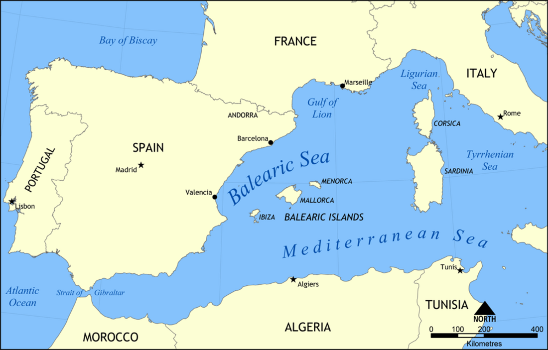
The Balearic Sea (endotoponym: Mar Balear in Catalan and Spanish) also known as Iberian Sea,[1] is a body of water in the Mediterranean Sea between the Balearic Islands and mainland Spain.[2] The Ebro River flows into this small sea.
| Balearic Sea | |
|---|---|
 | |
 Location of the Balearic Sea | |
| Location | Mediterranean Sea |

Islands and archipelagoes
The Balearic islands are divided into two groups: Gimnesias in the northeast, and Pitiusas in the southwest.[3]
Gimnesias
Pitiusas

Extent
The International Hydrographic Organization defines the limits of the Balearic Sea as follows:[4]
Between the Islas Baleares and the coast of Spain, bounded:
On the Southwest. A line from Cape Sant Antoni, Valencian Community (38°50′N 0°12′E) to Cape Berberia, the Southwest extreme of Formentera (Balearic Islands).
On the Southeast. The South Coast of Formentera, thence a line from Punta Rotja, its Eastern extreme, to the Southern extreme of Cabrera, Balearic Islands (39°07′N 2°54′E) and to Illa de l'Aire, off the Southern extreme of Menorca.
On the Northeast. The East coast of Menorca up to Cap Favaritx (40°00′N 4°14′E) thence a line to Cape Sant Sebastià Catalonia (41°54′N 3°10′E).
See also
References
Wikiwand - on
Seamless Wikipedia browsing. On steroids.
