Cardiff urban area
Urban area around Cardiff, Wales From Wikipedia, the free encyclopedia

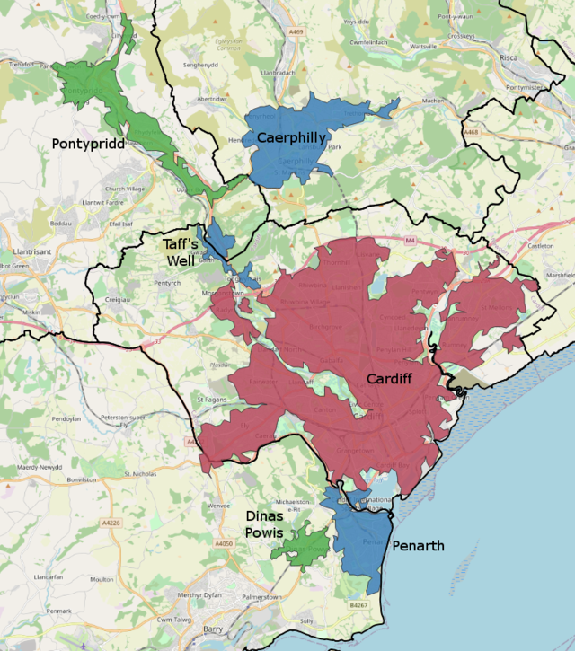
The Cardiff Built-up Area or Cardiff Urban Area is the name given to the urban area around Cardiff. The vast bulk of the population and area are contributed by Cardiff, which had a population of 335,145 at the 2011 census. The rest was made up by the towns of Penarth and Dinas Powys, connected to the south-west of the city along Cardiff Bay; as well as the South Wales Valleys towns of Caerphilly and Pontypridd. The total official population of this urban area was given to be 447,487 in 2011.[1] This was an increase of almost 37% on the 2001 population of 327,706. This was mainly due to Caerphilly and Pontypridd becoming part of the built-up area. The population of the Cardiff unitary authority (not co-terminous with the built-up area or the wider urban area) in 2001 was 305,353.[2] Cardiff Council estimated the population of the unitary authority at 317,500 in 2006;[citation needed] at the 2011 census it was 346,090.
Subdivisions
According to the ONS definition the Cardiff Urban Area had the following subdivisions:
| Rank | Urban sub-area | Population | |
|---|---|---|---|
| 2001 census | 2011 census | ||
| 1 | Cardiff | 292,150 | 335,145 |
| 2 | Caerphilly | 41,402 | |
| 3 | Pontypridd | 30,457 | |
| 4 | Penarth | 23,245 | 27,226 |
| 5 | Dinas Powys | 7,653 | 7,490 |
| 6 | Taff's Well | 5,567 | |
| Radyr | 4,658 | ||
| Total | 327,206 | 447,287 | |
Notes:
- Radyr was included in the Cardiff subdivision in the 2011 census.
- Pontypridd, Caerphilly and Taff's Well were separate urban areas in the 2001 census.
References
Wikiwand - on
Seamless Wikipedia browsing. On steroids.
