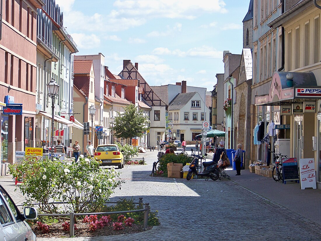
Calbe
Town in Saxony-Anhalt, Germany From Wikipedia, the free encyclopedia
Calbe (German pronunciation: [ˈkalbə]; official name: Calbe (Saale)) is a town in the district of Salzlandkreis, in Saxony-Anhalt, in east-central Germany.
This article needs additional citations for verification. (May 2010) |
Calbe | |
|---|---|
 | |
Location of Calbe within Salzlandkreis district  | |
| Coordinates: 51°54′12″N 11°46′33″E | |
| Country | Germany |
| State | Saxony-Anhalt |
| District | Salzlandkreis |
| Subdivisions | 5 |
| Government | |
| • Mayor (2021–28) | Sven Hause[1] |
| Area | |
• Total | 56.62 km2 (21.86 sq mi) |
| Elevation | 60 m (200 ft) |
| Population (2022-12-31)[2] | |
• Total | 8,222 |
| • Density | 150/km2 (380/sq mi) |
| Time zone | UTC+01:00 (CET) |
| • Summer (DST) | UTC+02:00 (CEST) |
| Postal codes | 39240 |
| Dialling codes | 039291 |
| Vehicle registration | SLK, SBK, BBG, ASL, SFT |
| Website | www.calbe.de |
Geography
Summarize
Perspective
It is situated on the river Saale, approx. 12 kilometers (7.5 mi) north of Bernburg, and 25 kilometers (16 mi) southeast of Magdeburg. It is known as Calbe an der Saale, to distinguish it from the smaller town of Kalbe on the Milde in the same state.[3]
Historically it was a railway junction, and among its industries were wool-weaving and the manufacture of cloth, paper, stoves, sugar and bricks. Cucumbers and onions were cultivated, and soft coal was mined in the neighborhood.[3][needs update]
The river Saale runs on the east side of the town, and over a weir. This is a small kind of dam where the water flows over the structure allowing passage of shallow draft barges up or down — moreover rather than being channeled through it the water is used off this flow to generate energy and it raises the water level only a relatively small amount.
At the weir, the Saale is partly diverted, while some of the river flows over the weir and continues on its natural path, the rest is channeled through an artificial path, known as "Mühlgraben". This takes the water between two (now abandoned) buildings which used to harness the power of the water to mill grain into flour, and the other to make paper. After flowing between the mills, the water continues on an artificial path for a couple of miles before returning to the Saale proper.
The small island of land between the Saale and the artificial "Mühlgraben" is called "Heger" in German. The local sports area and the swimming bath are located at the island. The island is connected to the city of Calbe by a bridge on the far side and also by a small ferry on the opposite side, which swings back and forth between the urban district "Gottesgnaden" (engl.: God's Grace) and island using an anchor and cable system.
Etymology
The name of the town comes from the verb "kalben", which means to calf (for a cow to give birth) in German, but it could also come from the Latin adjective "calvus", which describes a bleak landscape.
History
This section needs expansion. You can help by adding to it. (April 2025) |
In 1710, a commune of French Huguenots was founded in the town.[4]
Sights
The town has a statue of Roland outside its city hall. Roland is a symbol who represents many small and medium-sized towns in Saxony-Anhalt, symbolising free trade and prosperity. The town also has a very old church [citation needed], and a tower known as the "Hexenturm" ("Witchtower"), in which the townspeople imprisoned accused witches and tortured them in the Middle Ages. There is a Bismarck Tower at the Wartenberg in Calbe.
Culture
Calbe is famous for the long tradition for growing onions, which are regionally called "Bollen".
Wikimedia Commons has media related to Calbe (Saale).
Personality
Sons and daughters of the town
- Anna Margareta von Haugwitz (1622–1673)
- Carl Miller (1860–1930), local politician in Magdeburg
- Constantin von Dietze (1891–1973), agricultural scientist and theologian
- Hermann Bley (1936–2011), football player
- Christina Berger (born 1946), professor of materials science at the Darmstadt University of Technology
- Steffen Kammler (born 1965), Norwegian conductor
Personalities associated with Calbe

- Till Eulenspiegel, trickster figure
- Wilhelm Loewe (1814–1886), politician, President of the Rump Parliament
- Marie Nathusius, (1817–1857), narrator
- Christian Scriver, (1629–1693), theologian
References
Wikiwand - on
Seamless Wikipedia browsing. On steroids.


