Bolgart is a townsite north of Toodyay in Western Australia. It is in the Shire of Victoria Plains.
| Bolgart Western Australia | |
|---|---|
.JPG) Bolgart Hotel, 2014 | |
 Bolgart | |
 | |
| Coordinates | 31.274°S 116.511°E |
| Population | 128 (SAL 2021)[1] |
| Established | 1909 |
| Postcode(s) | 6568 |
| Elevation | 241 m (791 ft) |
| Area | 261 km2 (101 sq mi) |
| Location |
|
| LGA(s) | Shire of Victoria Plains |
| State electorate(s) | Moore |
| Federal division(s) | Durack |
The town derives its name from a nearby spring. The spring was discovered and the name recorded by explorer George Fletcher Moore in 1836. The area was settled in the 1840s and one of the first settlers, J Scully, named his property Bolgart. The townsite was gazetted in 1909.[2]
The name of the town is Aboriginal in origin and means place of water.
The town was struck by a magnitude 5.2 earthquake on 11 March 1952 followed by several aftershocks. The earthquake was felt as far away as Perth, where taller buildings were rocked.[3]
The reserves Drummond Nature Reserve and Bewmalling Nature Reserve are west and south west of this locality. The main industry in town is wheat farming with the town being a Cooperative Bulk Handling receival site.[4]
A railway line runs through Bolgart, which was the terminus of the Newcastle–Bolgart Railway before it was extended to Miling and became the Clackline–Miling railway.
The town also has a small agricultural museum housing a restored early twentieth century Marshall oil-fired tractor.
Gallery
 Bolgart CBH grain bins
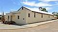 Bolgart Memorial Hall


References
See also
Wikiwand in your browser!
Seamless Wikipedia browsing. On steroids.
Every time you click a link to Wikipedia, Wiktionary or Wikiquote in your browser's search results, it will show the modern Wikiwand interface.
Wikiwand extension is a five stars, simple, with minimum permission required to keep your browsing private, safe and transparent.
