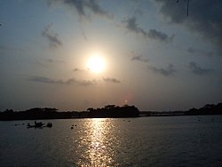
Baleshwari River
River in Bangladesh From Wikipedia, the free encyclopedia
The Baleshwari River is located in Bangladesh, forming part of the eastern border of Bagerhat District and the western border of Barguna District.[1] It borders on the east the largest mangrove forest in the world, in the Ganges-Brahmaputra delta, the Bangladesh part of which is set aside as the Sundarbans Reserve Forest. The 146 kilometers long Baleshwar flows south into the Haringhata River, which empties into the Bay of Bengal.
| Baleshwari River | |
|---|---|
 Baleshwar River | |
 | |
| Location | |
| Country | Bangladesh |
| Region | Barisal Division |
| Districts | Bagerhat and Barguna |
| Physical characteristics | |
| Source | Kaliganga River |
| • coordinates | 22°44′03″N 89°59′50″E |
| Mouth | Haringhata River (to the Bay of Bengal) |
• coordinates | 22°29′25″N 89°58′48″E |
| Length | 146 km (91 mi) |
See also
- Bihanga Island, island in the Baleshwari river.
References
Wikiwand in your browser!
Seamless Wikipedia browsing. On steroids.
Every time you click a link to Wikipedia, Wiktionary or Wikiquote in your browser's search results, it will show the modern Wikiwand interface.
Wikiwand extension is a five stars, simple, with minimum permission required to keep your browsing private, safe and transparent.
