Bad Grund
Place in Lower Saxony, Germany From Wikipedia, the free encyclopedia
Bad Grund (Harz) is a town in the district of Göttingen, in Lower Saxony, Germany. It is situated in the western Harz, approx. 7 km west of Clausthal-Zellerfeld, and 10 km north of Osterode am Harz.
Bad Grund | |
|---|---|
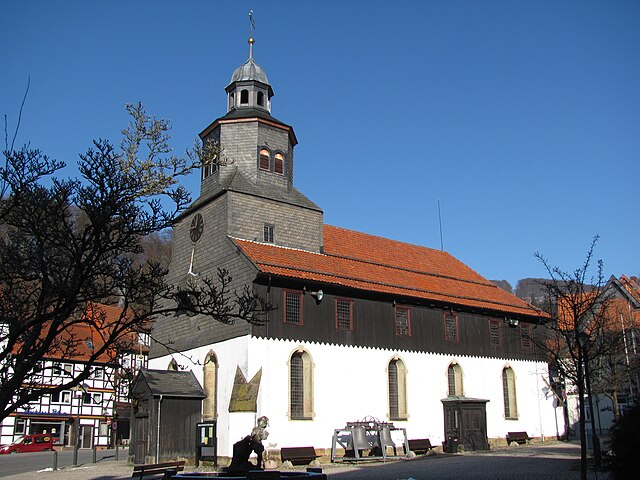
 Market square | |
Location of Bad Grund within Göttingen district  | |
| Coordinates: 51°48′41″N 10°14′18″E | |
| Country | Germany |
| State | Lower Saxony |
| District | Göttingen |
| Government | |
| • Mayor (2021–26) | Harald Dietzmann[1] (SPD) |
| Area | |
| • Total | 41.18 km2 (15.90 sq mi) |
| Elevation | 295 m (968 ft) |
| Population (2022-12-31)[2] | |
| • Total | 8,114 |
| • Density | 200/km2 (510/sq mi) |
| Time zone | UTC+01:00 (CET) |
| • Summer (DST) | UTC+02:00 (CEST) |
| Postal codes | 37539 |
| Dialling codes | 05327 |
| Vehicle registration | GÖ, OHA |
| Website | www |
Bad Grund is also the name of the former Samtgemeinde ("collective municipality") Bad Grund, of which Bad Grund formed part. It was disbanded in March 2013 and replaced by the Einheitsgemeinde Bad Grund.


Points of interest
- Historic Market Place
- St. Antony's Church was built in 1540. The church is surrounded by half-timbered houses dating from the 17th, 18th and 19th centuries[3]
- WeltWald Harz
- Hübichenstein
- Hilfe Gottes Mine
- Iberger Tropfsteinhöhle
References
Wikiwand in your browser!
Seamless Wikipedia browsing. On steroids.
Every time you click a link to Wikipedia, Wiktionary or Wikiquote in your browser's search results, it will show the modern Wikiwand interface.
Wikiwand extension is a five stars, simple, with minimum permission required to keep your browsing private, safe and transparent.


