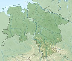
Alpe (Aller)
River in Germany From Wikipedia, the free encyclopedia
The Alpe is a river of Lower Saxony, Germany.
| Alpe | |
|---|---|
 | |
| Location | |
| Country | Germany |
| State | Lower Saxony |
| Physical characteristics | |
| Source | |
| • location | southwest of Dudensen |
| • coordinates | 52°35′34″N 9°25′12″E |
| • elevation | 46 m above sea level (NN) |
| Mouth | |
• location | in Rethem into the Aller |
• coordinates | 52°47′40″N 9°21′47″E |
• elevation | 18 m above sea level (NN) |
| Length | 30.5 km (19.0 mi) [1] |
| Basin size | 252 km2 (97 sq mi) [1] |
| Basin features | |
| Progression | Aller→ Weser→ North Sea |
| Landmarks | |
| Tributaries | |
| • left | Laderholzer Moorgraben, Steimbker Dorfgraben, Moorbeeke, Alpengraben, Wölpe |
| • right | Lutterer Bach, Neuer Eilter Graben, Schotengraben |
The Alpe is a left tributary of the Aller. Its source lies between the villages of Dudensen and Nöpke, both within the town of Neustadt am Rübenberge. It initially crosses the Dudensen Bog and flows along the edge of the Bog Lichtenmoor and past Rethem Bog. In the 1970s it lost its natural character, it was straightened and, in places, canalised. The Steimbker Dorfgraben, a drainage ditch joining it from the left, is very heavily polluted (water quality class III–IV). The Alpe itself has a good overall water quality (class II = moderately polluted).[2] Before the town of Rethem the Weiße Graben ("White Ditch") joins the Alpe along with the Wölpe. In Rethem the Alpe then discharges into the Aller.
See also
References
Wikiwand - on
Seamless Wikipedia browsing. On steroids.

