Çamardı District
District of Niğde Province, Turkey From Wikipedia, the free encyclopedia
Çamardı District is a district of the Niğde Province of Turkey. Its seat is the town of Çamardı.[1] Its area is 1,163 km2,[2] and its population is 11,495 (2022).[3]
Çamardı District | |
|---|---|
 Elekgölü and hills, Çamardı | |
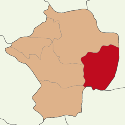
 Map showing Çamardı District in Niğde Province | |
| Coordinates: 37°50′N 34°59′E | |
| Country | Turkey |
| Province | Niğde |
| Seat | Çamardı |
| Government | |
| • Kaymakam | İlhan Kayaş |
Area | 1,163 km2 (449 sq mi) |
| Population (2022) | 11,495 |
| • Density | 9.9/km2 (26/sq mi) |
| Time zone | UTC+3 (TRT) |
| Website | www |
Composition
There is one municipality in Çamardı District:[1]
References
Wikiwand - on
Seamless Wikipedia browsing. On steroids.


