Stötten
Municipality in Bavaria, Germany From Wikipedia, the free encyclopedia

Stötten (Swabian: Steeda) is a municipality in the district of Ostallgäu in Bavaria in Germany.
Stötten | |
|---|---|
 Stötten am Auerberg seen from the west | |
 Coat of arms | |
Location of Stötten within Ostallgäu district 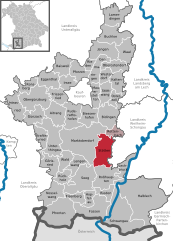 | |
 Stötten  Stötten | |
| Coordinates: 47°44′N 10°41′E | |
| Country | Germany |
| State | Bavaria |
| Admin. region | Schwaben |
| District | Ostallgäu |
| Government | |
| • Mayor (2023–29) | Michael Neumann[1] |
| Area | |
| • Total | 40.75 km2 (15.73 sq mi) |
| Elevation | 733 m (2,405 ft) |
| Population (2023-12-31)[2] | |
| • Total | 1,996 |
| • Density | 49/km2 (130/sq mi) |
| Time zone | UTC+01:00 (CET) |
| • Summer (DST) | UTC+02:00 (CEST) |
| Postal codes | 87675 |
| Dialling codes | 08349 |
| Vehicle registration | OAL |
| Website | www.stoetten.de |
Climate
| Climate data for Stötten (1991–2020 normals) | |||||||||||||
|---|---|---|---|---|---|---|---|---|---|---|---|---|---|
| Month | Jan | Feb | Mar | Apr | May | Jun | Jul | Aug | Sep | Oct | Nov | Dec | Year |
| Mean daily maximum °C (°F) | 1.7 (35.1) |
2.8 (37.0) |
7.2 (45.0) |
12.2 (54.0) |
16.2 (61.2) |
19.7 (67.5) |
21.7 (71.1) |
21.7 (71.1) |
16.8 (62.2) |
11.7 (53.1) |
5.8 (42.4) |
2.6 (36.7) |
11.7 (53.1) |
| Daily mean °C (°F) | −0.7 (30.7) |
−0.1 (31.8) |
3.5 (38.3) |
7.8 (46.0) |
11.8 (53.2) |
15.2 (59.4) |
17.1 (62.8) |
17.0 (62.6) |
12.7 (54.9) |
8.3 (46.9) |
3.2 (37.8) |
0.2 (32.4) |
8.0 (46.4) |
| Mean daily minimum °C (°F) | −3.1 (26.4) |
−2.7 (27.1) |
0.3 (32.5) |
3.8 (38.8) |
7.7 (45.9) |
11.1 (52.0) |
13.0 (55.4) |
13.2 (55.8) |
9.4 (48.9) |
5.5 (41.9) |
0.9 (33.6) |
−2.2 (28.0) |
4.8 (40.6) |
| Average precipitation mm (inches) | 75.7 (2.98) |
61.4 (2.42) |
79.0 (3.11) |
62.6 (2.46) |
108.8 (4.28) |
100.4 (3.95) |
127.1 (5.00) |
97.8 (3.85) |
82.0 (3.23) |
85.3 (3.36) |
83.3 (3.28) |
85.5 (3.37) |
1,056.5 (41.59) |
| Average precipitation days (≥ 1.0 mm) | 18.8 | 16.7 | 15.5 | 13.2 | 13.1 | 14.5 | 15.4 | 15.7 | 13.9 | 16.4 | 18.0 | 19.3 | 191.3 |
| Average snowy days (≥ 1.0 cm) | 18.5 | 17.7 | 10.9 | 2.1 | 0.1 | 0 | 0 | 0 | 0 | 0.4 | 6.1 | 14.3 | 70.1 |
| Average relative humidity (%) | 88.0 | 83.9 | 78.1 | 71.2 | 74.3 | 74.8 | 73.4 | 73.4 | 80.9 | 86.9 | 90.5 | 89.6 | 80.4 |
| Mean monthly sunshine hours | 63.6 | 84.8 | 132.6 | 181.3 | 207.1 | 224.1 | 241.3 | 227.2 | 163.0 | 107.2 | 59.6 | 52.9 | 1,744.7 |
| Source: World Meteorological Organization[3] | |||||||||||||
References
Wikiwand in your browser!
Seamless Wikipedia browsing. On steroids.
Every time you click a link to Wikipedia, Wiktionary or Wikiquote in your browser's search results, it will show the modern Wikiwand interface.
Wikiwand extension is a five stars, simple, with minimum permission required to keep your browsing private, safe and transparent.