Rural Municipality of Newcombe No. 260
Rural municipality in Saskatchewan, Canada From Wikipedia, the free encyclopedia
The Rural Municipality of Newcombe No. 260 (2016 population: 342) is a rural municipality (RM) in the Canadian province of Saskatchewan within Census Division No. 8 and SARM Division No. 3. It is located in the west-central portion of the province.
Newcombe No. 260 | |
|---|---|
| Rural Municipality of Newcombe No. 260 | |
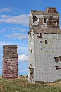
 Old grain elevators in Dankin | |
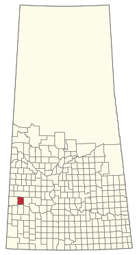
 Location of the RM of Newcombe No. 260 in Saskatchewan | |
| Coordinates: 51.042°N 109.111°W[1] | |
| Country | Canada |
| Province | Saskatchewan |
| Census division | 8 |
| SARM division | 3 |
| Formed[2] | December 11, 1911 |
| Government | |
| • Reeve | Ken McBride |
| • Governing body | RM of Newcombe No. 260 Council |
| • Administrator | Monica Buddecke |
| • Office location | Glidden |
| Area (2016)[4] | |
| • Land | 1,075.6 km2 (415.3 sq mi) |
| Population (2016)[4] | |
| • Total | 342 |
| • Density | 0.3/km2 (0.8/sq mi) |
| Time zone | CST |
| • Summer (DST) | CST |
| Area code(s) | 306 and 639 |
History
The RM of Newcombe No. 260 incorporated as a rural municipality on December 11, 1911.[2] It is named after Allan Simpson Newcombe who played a leadership role in establishing the Boston Colony of immigrants from Massachusetts.[citation needed]
- Heritage properties
There is one designated heritage property in the RM.
- Ukrainian Catholic Parish of St. John the Baptist - Constructed in 1944 the church is located 20 km southwest of Kindersley. The site also contains a one-room school that was related to the site in 1961 for use as a church hall. Religious services were last conducted at the church in 1986.[5]
Geography
Communities and localities
The following unincorporated communities are within the RM.
- Localities
Demographics
In the 2021 Census of Population conducted by Statistics Canada, the RM of Newcombe No. 260 had a population of 356 living in 110 of its 133 total private dwellings, a change of 4.1% from its 2016 population of 342. With a land area of 1,094.64 km2 (422.64 sq mi), it had a population density of 0.3/km2 (0.8/sq mi) in 2021.[8]
In the 2016 Census of Population, the RM of Newcombe No. 260 recorded a population of 342 living in 112 of its 119 total private dwellings, a -14.5% change from its 2011 population of 400. With a land area of 1,075.6 km2 (415.3 sq mi), it had a population density of 0.3/km2 (0.8/sq mi) in 2016.[4]
Government
The RM of Newcombe No. 260 is governed by an elected municipal council and an appointed administrator that meets on the second Thursday of every month.[3] The reeve of the RM is Ken McBride while its administrator is Monica Buddecke.[3] The RM's office is located in Glidden.[3]
Transportation
The RM is at the intersection of Highway 21 and Highway 44. The Lemsford Ferry is located within the RM.
References
Wikiwand in your browser!
Seamless Wikipedia browsing. On steroids.
Every time you click a link to Wikipedia, Wiktionary or Wikiquote in your browser's search results, it will show the modern Wikiwand interface.
Wikiwand extension is a five stars, simple, with minimum permission required to keep your browsing private, safe and transparent.

